- Every mapping project gets screened by environmental issues
- Every mapping project gets checked about the accordance to the national version of the mapping norm (Symbolization, minimal gaps and sizes) and usually also field checked in regard to proper interpretation and generalization.
- Additionally also proper drawing is an issue.
- The maps quality promotion is executed by one of 13 consultants, each in charge for a certain region of Switzerland. These are all among the most experienced mappers we have and some of them are even closely linked to OCAD. Their role is consultative and as such they are in a mainly supporting and educating role. If the map is drawn for a member association of Swiss Orienteering, the Federation stands for the costs of the consultant.
- A good cooperation between mapper and consultant usually results in the map being Q-labeled, represented by the Q behind the official map number.

- From 2014 the label of the Federation will even include a rough information about the actual print quality of the map in hand. See figure above.
Dienstag, 26. November 2013
Mappers Blog: The swiss quality management system for orienteering maps
Orienteering map production in Switzerland is supervised by the national orienteering federation. Here I give a short outline on the system regulated by the Kartenreglement des Schweizer Orientierungslauf Verbandes. I refere to the version which will be introduced in 2014.

Donnerstag, 21. November 2013
Mappers Blog: How to get an object height basemap with Swiss Laser Data
Update: Read Jerker Bomans comment below. Swiss authorities provide two kind of processed terrain laser data. A DTM named DOM (Digitales Oberflächen Modell) and a DEM named SwissAlti3D (Digtales Höhenmodell), so basically two surfaces, one with (DTM) one without vegetation and buildings (DEM).
For mappers the object height is a useful perspective. With OCAD11 this perspective became accessible for mappers working with Swiss Data. For those who did not upgrade I describe a work around. Acutally it is possible to achieve the perspective with the freeware OL-Laser by modifying and fusion the two datasets.
Basically the Swiss Data consists in textfiles, with one points coordinates per line.
601999.58 196042.04 622.55Now help OL Laser to interpret this coordinate with some additional information.
601999.58 196042.04 622.55 9 2 1 1This by adding 4 values for intensity, number of returns, return number, classification behind the coordinates. In the example you have the signature for "surface": intensitiy 9, first return of two, unclassified. This signature you can add to the coordinates of the DOM.
For the DEM the signature looks like this
600005.00 196001.00 762.11 31 2 2 2Here I choose an intensity of 31 (just an arbitrary value). It is the second return of two (last return) and the point is classified as ground.
That was it: Modify the lines, fusion the two files and then proceed to OL-Laser.

fig.1. Object height perspective of "Gurten Nordhang" produced with OL Laser.
By the way. The similar trick also makes the Swiss Data useable to the automatic map generator karttapullautin, only that the order in the signature to add is different. Here it is x,y,z,classification,returns,return nro, intensity. You therefore got to switch the places of classification and intensity.
600005.00 196001.00 762.112 2 2 31 (ground)
601999.58 196042.04 622.551 2 1 9 (surface)

Dienstag, 5. November 2013
Mappers Blog: Some simple measures to meet the ISOM2000 in regard of legibility
To meet the ISOM2000 in regard of legibility it is might be worth to add some extra symbols to your set. Used during the drawing, they easily can be removed for the final version.


- Minimal objects as point features (here: impassable cliff, passable rock face and marsh) to avoid too small objects.
- Visual buffers for minimal gaps (pink: between buffered objects, green: between a buffered object an object of the same color
- Meter for minimal contour detail.
- Meter for minimal knoll (if smaller, replace with small knoll or elongated knoll)
Mittwoch, 30. Oktober 2013
Andreas Kyburz modifies the rules
Swiss Selections 2014
The selections for the Swiss National Team are out now (seniors - juniors). There we can see the following changes for the season 2014:freshly selected: Paula Gross, Laura Diener, Hanna Müller, Kerstin Ullmann, Jan Brunner, Thomas Curiger, Tobia Pezzati, Janis Schönleber, Noah Zbinden, Patrick Zbinden (all J) and Lilly Gross (B)
upgraded: Sabine Hauswirth (B->A), Marion Aebi (J->B), Martin Hubmann (B->A), Andreas Kyburz (B->A), Florian Schneider (J->U23), Christoph Meier (J->B)
retired: Simone Niggli, Matthias Leonhardt, Matthias Merz (all A) , Seline Stalder, and Severin Howald (both B).
deselected: Térence Risse, Isamel Röthlisberger, Simon Wenger, Sebastian Gygax (all J), Franziska Dörig and Sophie Tritschler (both B)
Selection dynamics since 1999

I updated the chart with the selection dynamics since 1999.
Modifying the rules
Last year o-zeugs defined a set of unwritten rules describing the selection dynamics for the 2013 mens team and some prognoses where made. Martin Hubmann and Florian Schneider got their upgrades and Andreas Kyburz broke rule 2 (while rule 3 was wrong from the beginning). Here are the modified rules in recent mens selection history:
- No runner, not directly upgraded from the junior team to the senior team made it into the senior team later on. (unchanged)
- No athlete which did not made it into the U-23 (=under the frist three years as a senior) was later upgraded into the A-team (modified)
- (omitted)
- The lastest chance to make it into the A-team is after the fifth season. (unchanged)
- To directly make it into the U-23, you have to win a JWOC medal. (unchanged)
We are family
- Bettina and Marion Aebi
- Paula, Lilly and Julia Gross
- Matthias and Andreas Kyburz
- Daniel and Martin Hubmann
- Mjriam and Sven Hellmüller
- Ines Brodmann,
- Rahel Friederich
- Laura Diener
- Florian Howald
- Yves Aschwanden
- Joël Borner
- Thomas Curiger
Freitag, 25. Oktober 2013
Mappers Blog: Svartviksskogen basemap

fig.1. Basemap for mapping Svartviksskogen.
- Contours: Black contours according to the maps equidistance, green: band for the contour, red: for formlines. Made with OL Laser.
- Vegetation height: White: forest, green: up to 5m, yellow: upp to 80cm. Made with OL Laser.
- Regions with bad signal density.
- Communal vector data of roads and buildings
- North lines
- Crosshairs for proper positioning of the field notes scan
Dienstag, 8. Oktober 2013
World Cup 1986 Sweden
I got the map from the World Cup 1986 Sweden /Fjärås from okansas.
 fig.1. Map of the World Cup 1986 Sweden Fjärås, Classic distance men
So the collection of World Cup maps form 1986 is now complete.

So the collection of World Cup maps form 1986 is now complete.
Sonntag, 6. Oktober 2013
Mappers Blog: The JEC 2013 long distance map

fig.1. Excerpt of the JEC 2013 Long Distance Map "Les Hautes Gouttes" by Radim Ondracek, Petr Matula, Zdenek Lenhart, Ivo Haban and JB Bourrin.

Many big names on this map but still a lot more small bushes. :-P This is what Ivo calls the Brno -school.
Mappers Blog: Field notes of Urs Steiner

fig.1. La Givrine 2011. Base Map (1m contours, index contours, vegetation and some details from the aerial image (wall, track)). Field note (naturalistic but blue for 406 and green for 408, no eraser but pencil for the "final line", cross for stones,..). Steiner mapped this map for the WOC 2012 Middle Distance Final. Before the WOC the map was revisioned (fig.2.).

fig.2. Differences between the maps Givrine 2011 and WOC 2012.
The last revision had three main issues: the threshold for undergrowth (407/409) was raised. Some clearances where added or altered (near control points). Top and bottom-features (112 small knoll, 115 small depression) where replaced by equivalent contour-line features.
Running over settlement II
Unfortunately our system doesn’t save (or send) HDOP etc. values. Only figure to use here is number of satellites and on those occasions it has been 7-8, same level as on the other parts of course. In my opinion can’t say based on that track with required certainty that she was in the forbidden area.Mr. gpsseuranta via e-mail
Freitag, 4. Oktober 2013
Running over settlement
Here is an example of a case of a runner running over settlement area according to the GPS-tracking. The jury decided to not disqualify her.
fig.1. The runners route according to the Live-GPS-Track
 fig.2. After the race, the runner is asked about it and sooner published the route she was running (here in red)
And commented:
Protest
The team of another runner protested against the runners classification, but the protest was neglected.
Some comments on this
1)The quality of the GPS positioning depends on the number and distribution of the satellites the GPS receiver can connect to. The number of satellites available in a given area to a given time is basically defined by the local horizon. The horizon in the area in question shows no significant differences or specialties relative to the rest of the competition area. No slope, no deep valley, no cliffs.
2) Looking on the entire track of this runner, the positioning is working with a good precision (controlpoint and tracks as reference) from the start to just in front of the settlement area and just after the settlement area into the finish.
3) The map is based on laser-data and therefore fully georeferenced. The gps-track shows a good accordance with the map. The track avoids unnecessary climbs and buildings or rockfaces.
4) The calculated speed on the gps-track shows a high accordance to the terrain (faster when on the plain, slower uphill and crossing the trench). Additionally the gps-track show no "jumps" to catch up to the right position.
 fig.3. Paceview of the gps-track (Quickroute)
5) The density of position-points is according to the rest of the track
 6) The track according to the runner bends to the right, where as the gps-track bends to the left. (Similar behaviour was screened from Tiomila 2011, ex. 2 path passing lake, several runners track show this error)
 7) It is not likely, that the powerline influences the position accuracy (->read this)
fig.1. The runners route according to the Live-GPS-Track

And commented:
Och så till min GPS-rutt som har skapat lite problem. På bilden nedan är GPS:en och i rött hur jag anser att jag har sprungit. Jag har dock inte så jättemånga minnesbilder från det här partiet av banan. När jag har flyt, full koll och hela tiden vet var jag är och vart jag ska brukar jag inte komma i håg så mycket efteråt. Jag vet ju hur jag har sprungit men jag kommer oftast inte ihåg hur det såg ut eller vad jag tänkte. Däremot när jag är osäker, inte har riktig koll eller gör misstag, då kommer jag oftast ihåg exakt hur det såg ut och vad jag tänkte. Lite dålig egenskap kanske eftersom det gör det betydligt lättare att ta med sig dåliga saker än bra saker. I det här fallet hade jag väldigt bra koll, jag kommer dock ihåg att jag tänkte springa upp precis efter branten vid huset men fortsatte för att det såg bökigt ut (ändrad plan, ur fokus = tydligt minne). Jag har också två korta minnesbilder av när jag viker av kraftledningen till stigen och att jag senare spanar tillbaka mot kraftledningen för att se så att jag håller lagom avstånd. Så här i efterhand var det ju väldigt onödigt av mig att ta det här vägvalet speciellt eftersom det inte ens var särskilt bra. Arrangörerna hade inte någon tanke på att någon skulle välja att springa där och enligt dem var det också sämre gps-täckning i just det området. Så om nu ingen har manipulerat mitt minne drar jag slutsatsen att jag inte har sprungit på någon tomtmark.So she explains the difference between the GPS-track and her reality with "locally bad signal coverage".
Protest
The team of another runner protested against the runners classification, but the protest was neglected.
2013-09-29 kl. 13.50from orientering.se
Tävlingsledningen för stafett-SM 2013 har beslutat att det inte har begåtts något fel efter GPS-trackingen för D21. Detta efter att karta har studerats och konferering med banläggare, tomten är en naturtomt, diffust markerad i natur med mycket sly. En del av tomten har markerats i natur men inte vid det specifika området.
Tävlingsledarna:
Christer Westberg, IFK Göteborg
Cecilia Groth, Kungälvs OK
2013-09-29 kl. 13.52
PROTEST
GMOK har protesterat mot tävlingsledningens beslut att fria Tove Alexanderssons löpväg genom/över tomtmark till första kontrollen på str. 3 i SM-stafetten 2013.
Hans Melin, GMOK
2013-09-29 kl. 14.45
Jurybeslut
PROTESTEN AVSLÅS!
Löparens beskrivning av hur och var hon sprungit efter tomten stämmer överens med att GPS-trackingen förskjutits ca 30 m i syd-sydostlig riktning. Trots att GPS i andra delar av banan varit mycket säker så kan den i denna dalgång i närheten av kraftledning ha en osäker visning. Det enda argument som GMOK framfört till juryn är att GPS-trackingen visar passage av tomtmark.
Claes Andersson
Peter Andersson
Christer Ljungdahl
Some comments on this
1)The quality of the GPS positioning depends on the number and distribution of the satellites the GPS receiver can connect to. The number of satellites available in a given area to a given time is basically defined by the local horizon. The horizon in the area in question shows no significant differences or specialties relative to the rest of the competition area. No slope, no deep valley, no cliffs.

2) Looking on the entire track of this runner, the positioning is working with a good precision (controlpoint and tracks as reference) from the start to just in front of the settlement area and just after the settlement area into the finish.
3) The map is based on laser-data and therefore fully georeferenced. The gps-track shows a good accordance with the map. The track avoids unnecessary climbs and buildings or rockfaces.
4) The calculated speed on the gps-track shows a high accordance to the terrain (faster when on the plain, slower uphill and crossing the trench). Additionally the gps-track show no "jumps" to catch up to the right position.

5) The density of position-points is according to the rest of the track

Montag, 23. September 2013
The international season 1986
1986 was the year Lars Palmquist ran all comptetions of the World Cup but one plus the Nordic Championships. With his maps and one from okansas I recap the international season 1986.
1986 was the first official World Cup, which then was held every second year until 2004. From then the World Cup was held annually (more about the World Cup on wikipedia.org and the World Cup 1986 on the IOF website. Elite runners on the international level alternated a year with orienteering all over the world with a year with the focus on the World Championships.
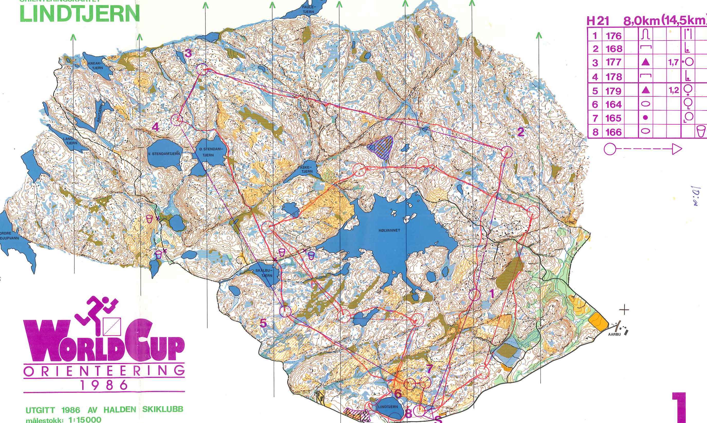 fig.1. Individual
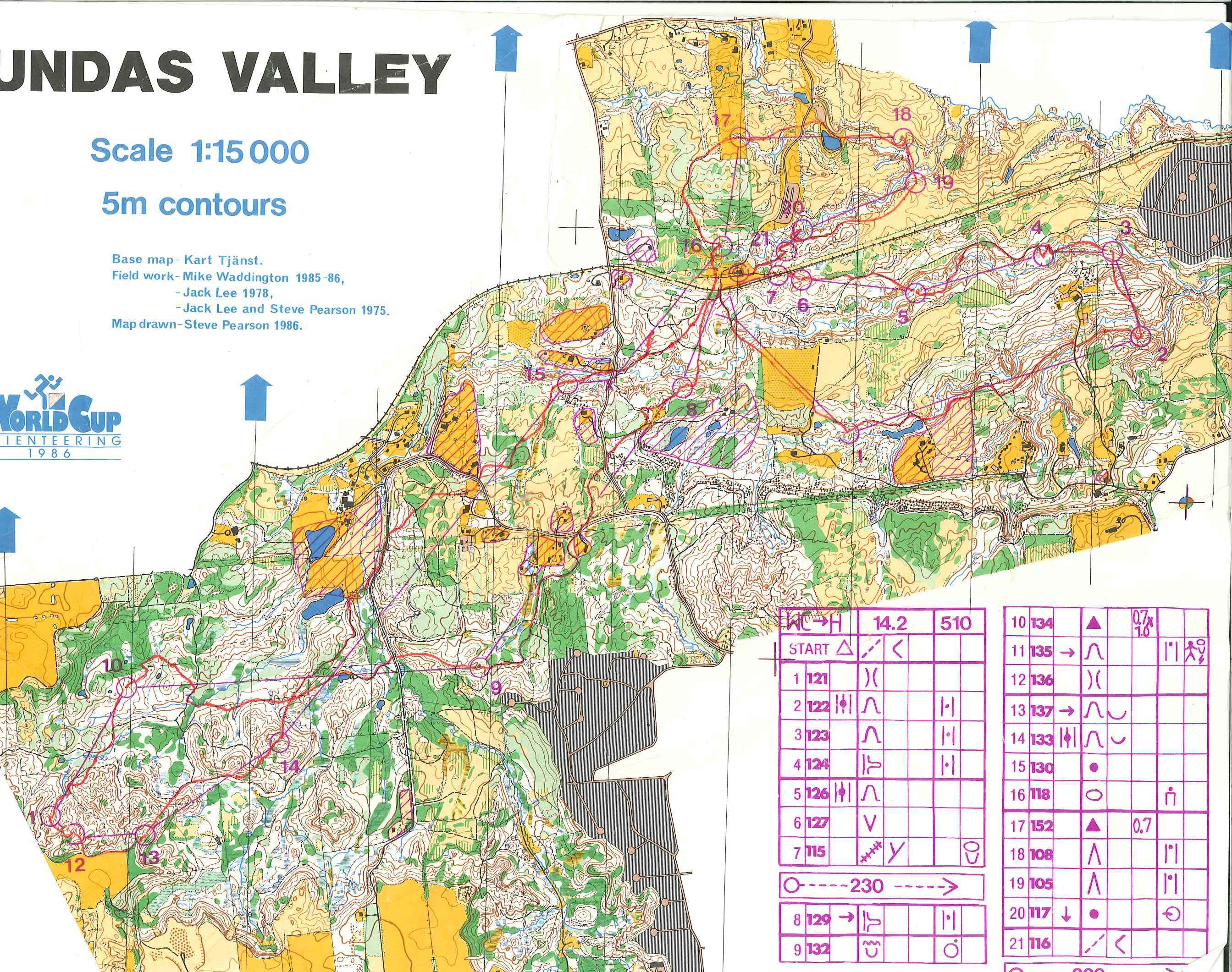
fig.2. Individual
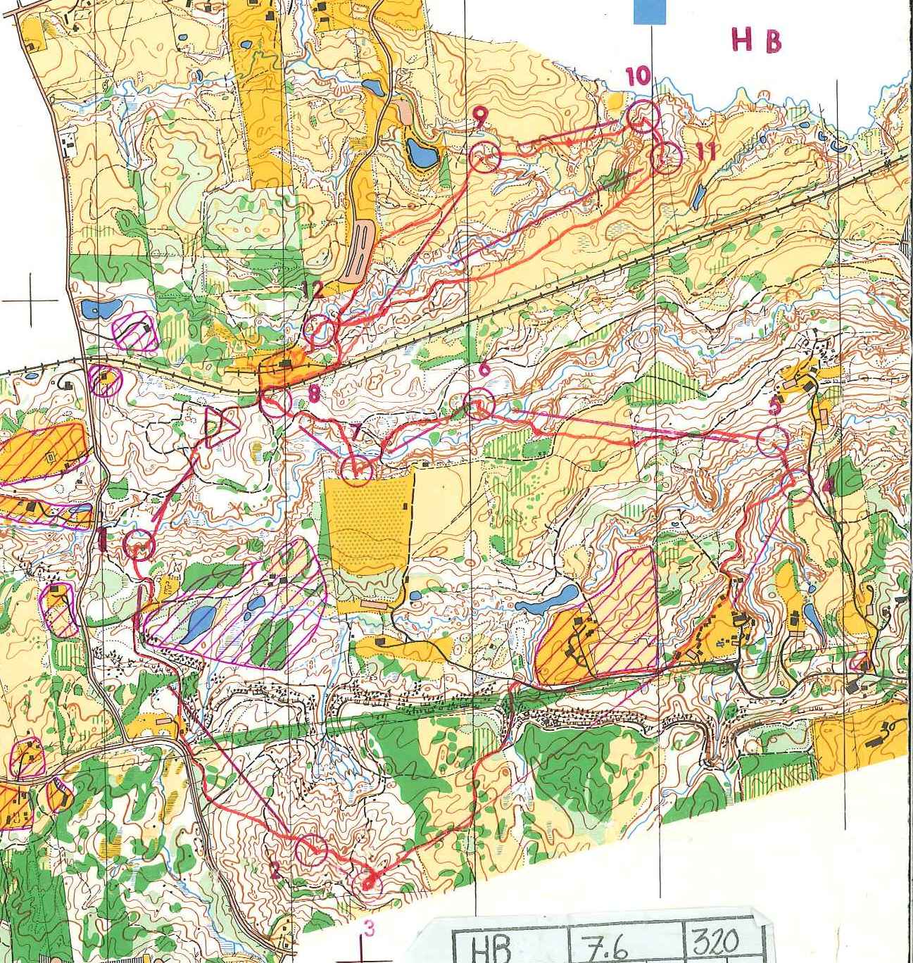
fig.3. Relay
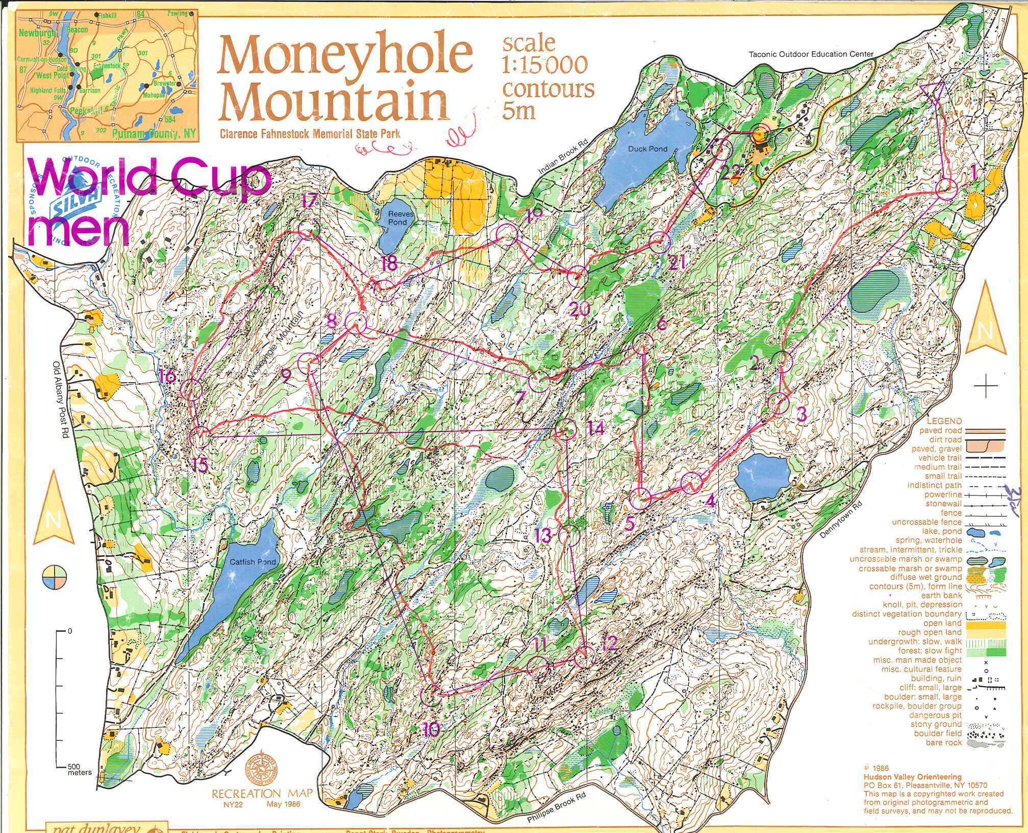 fig.4. Individual
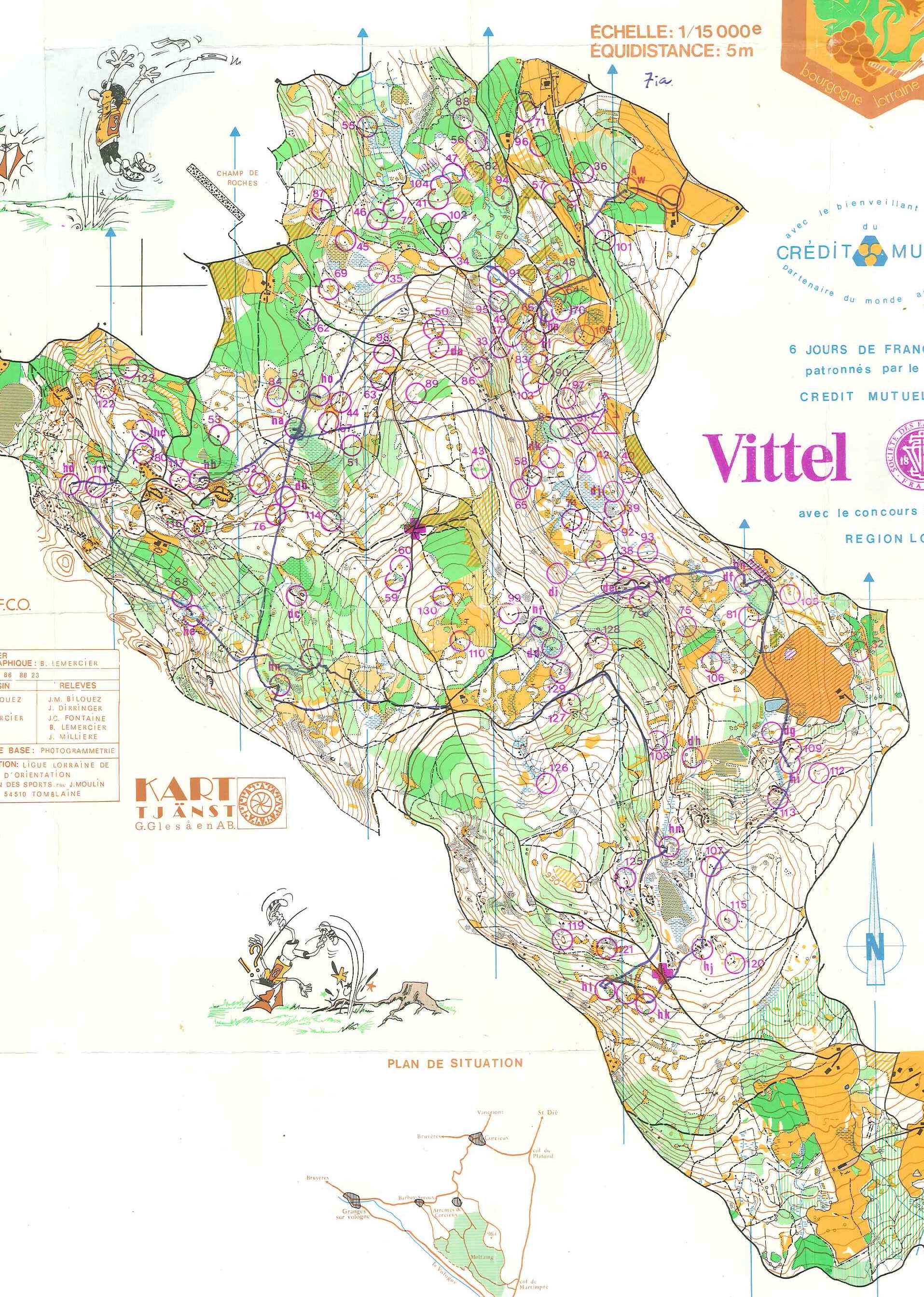 fig.5. Individual
 fig. 5b. Individual
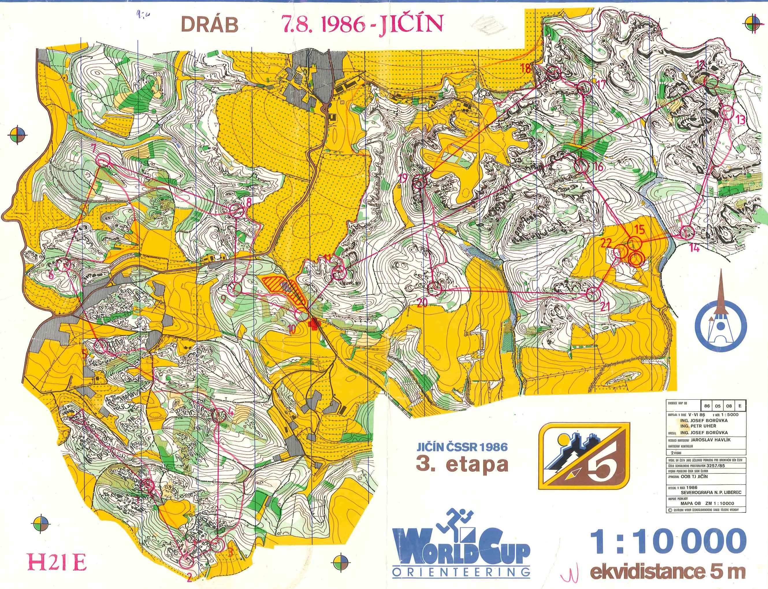
fig.6. Individual
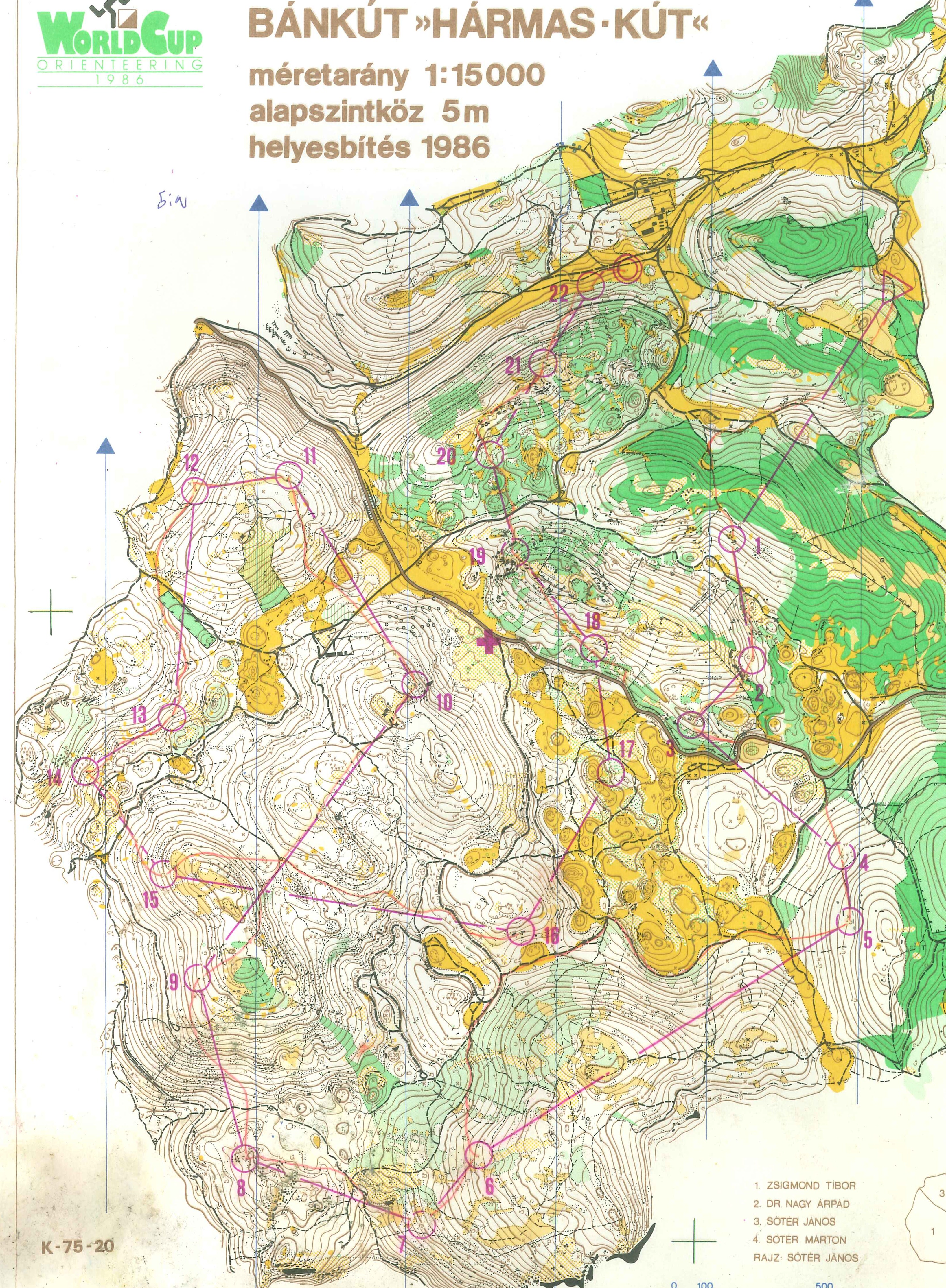
fig.7. Individual
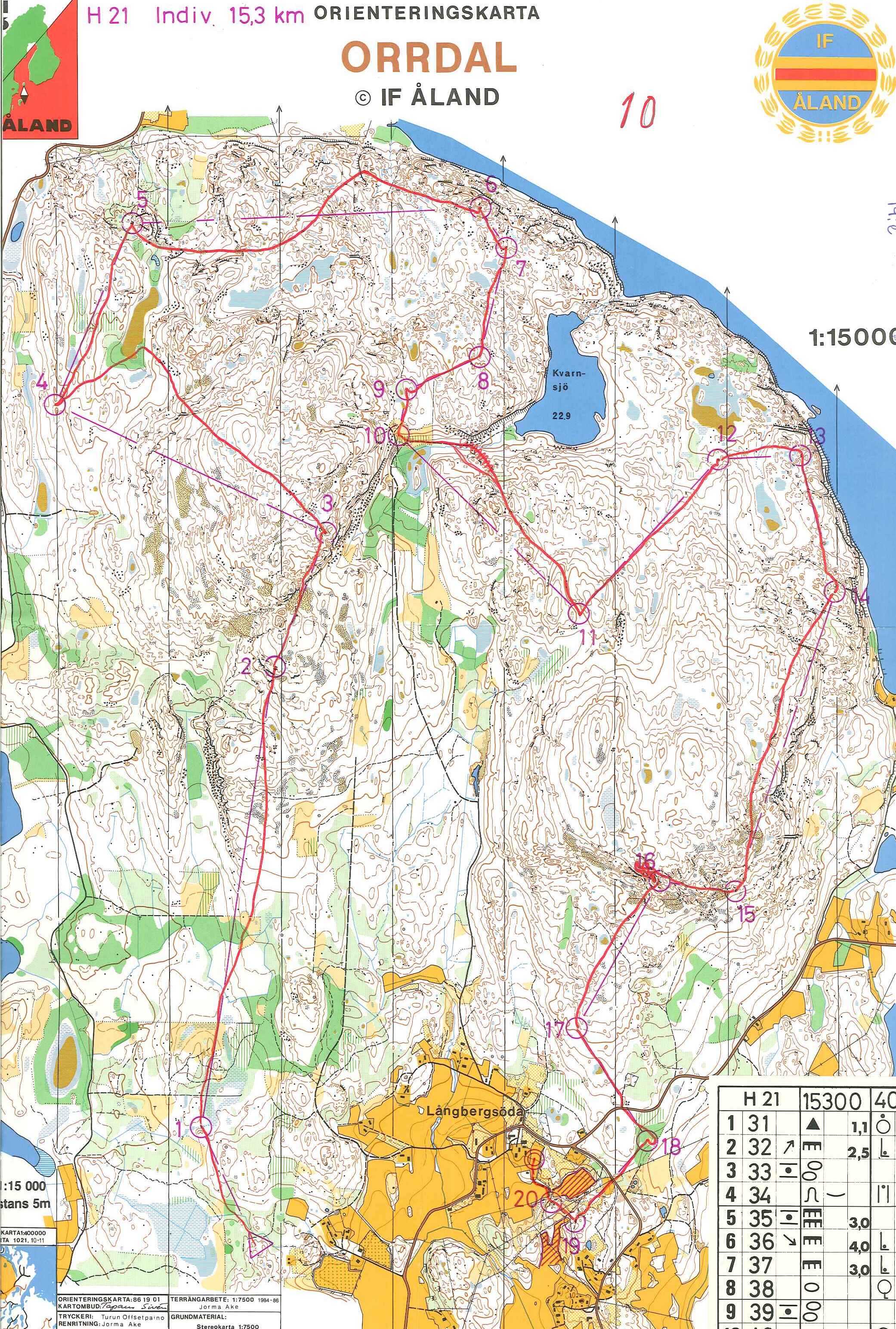
fig.8. Individual
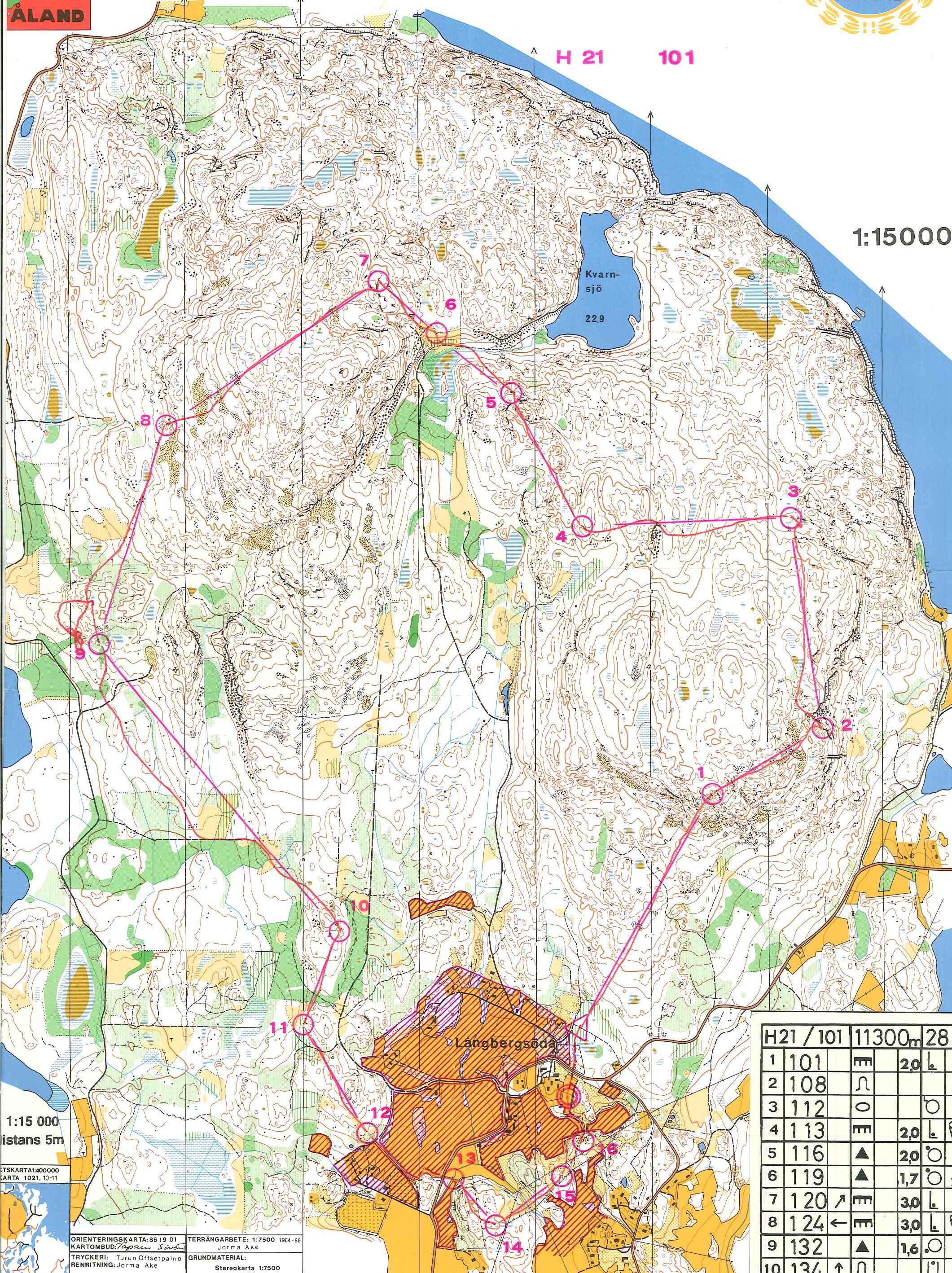
fig.9. Relay
World Cup, Stäfa, Switzerland, October 1986
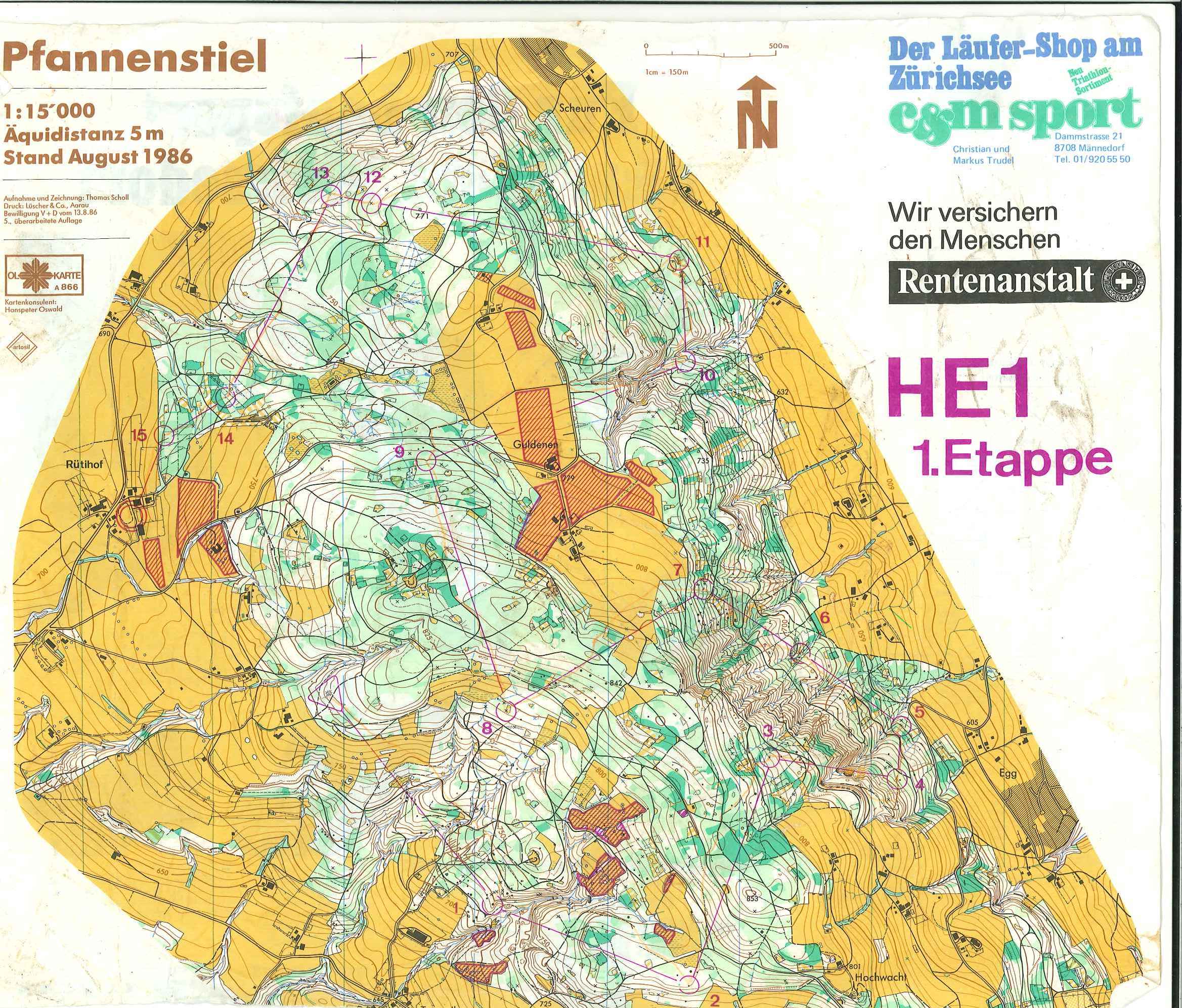 fig.10. Individual. First part.
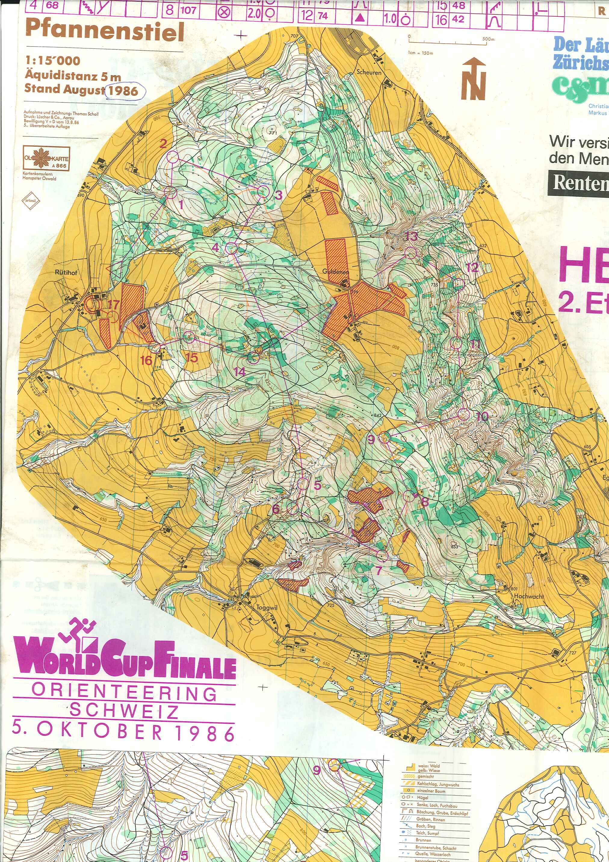 fig.11 Individual. Second part. (Chase-start? Map excerpt in larger scale and with different equidistance?)
1986 was the first official World Cup, which then was held every second year until 2004. From then the World Cup was held annually (more about the World Cup on wikipedia.org and the World Cup 1986 on the IOF website. Elite runners on the international level alternated a year with orienteering all over the world with a year with the focus on the World Championships.
World Cup Halden, Norway, May 1986
World Cup Hamilton, Canada, May 1986
fig.2. Individual
fig.3. Relay
World Cup Fahnestock State Park, USA, May 1986
World Cup Raon L'Etape, France, July 1986
World Cup Fjärås, Sweden, July 1986

World Cup Jičín, Czechoslovakia, August 1986
fig.6. Individual
World Cup Eger/Bánkút, Hungary, August 1987
fig.7. Individual
Nordic Open Championships, Åland, Finland, August 1987
fig.8. Individual
fig.9. Relay
World Cup, Stäfa, Switzerland, October 1986
Abonnieren
Posts (Atom)
o-zeugs over and out (late wc china finding)
Yes. Let the o-zeugs blog rest in peace. I´ll take it down eventually. And yes, I stumbled over the decisions of the Ethics Panel regarding ...

-
 I here describe the way of the couch-mapper or with other words how far you can get with a swedish .las file (and karttapullautin , OL Lase...
 -
 Yes. Let the o-zeugs blog rest in peace. I´ll take it down eventually. And yes, I stumbled over the decisions of the Ethics Panel regarding ...