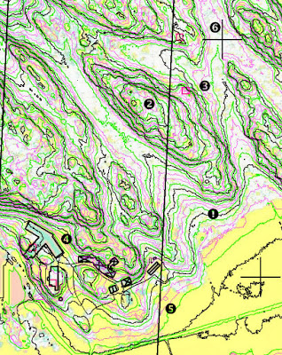
fig.1. Basemap for mapping Svartviksskogen.
- Contours: Black contours according to the maps equidistance, green: band for the contour, red: for formlines. Made with OL Laser.
- Vegetation height: White: forest, green: up to 5m, yellow: upp to 80cm. Made with OL Laser.
- Regions with bad signal density.
- Communal vector data of roads and buildings
- North lines
- Crosshairs for proper positioning of the field notes scan


2 Kommentare:
"green: band for the contour" is that where you accept deviation for a particular contour or how do I have to understand this?
"It is permissible to alter the height of a contour slightly if this will improve the repre-
sentation of a feature. This deviation should not exceed 25% of the contour interval and attention must be paid to neighbouring features."
(IOF Map Committee 2000)
The green band is plus and minus 20%. Personally I do not 100% follow this rule for ex. while emphasizing forms in slopes.
Kommentar veröffentlichen