Montag, 23. September 2013

The international season 1986

1986 was the year Lars Palmquist ran all comptetions of the World Cup but one plus the Nordic Championships. With his maps and one from okansas I recap the international season 1986.

1986 was the first official World Cup, which then was held every second year until 2004. From then the World Cup was held annually (more about the World Cup  on wikipedia.org and the World Cup 1986 on the IOF website. Elite runners on the international level  alternated a year with orienteering all over the world with a year with the focus on the World Championships.

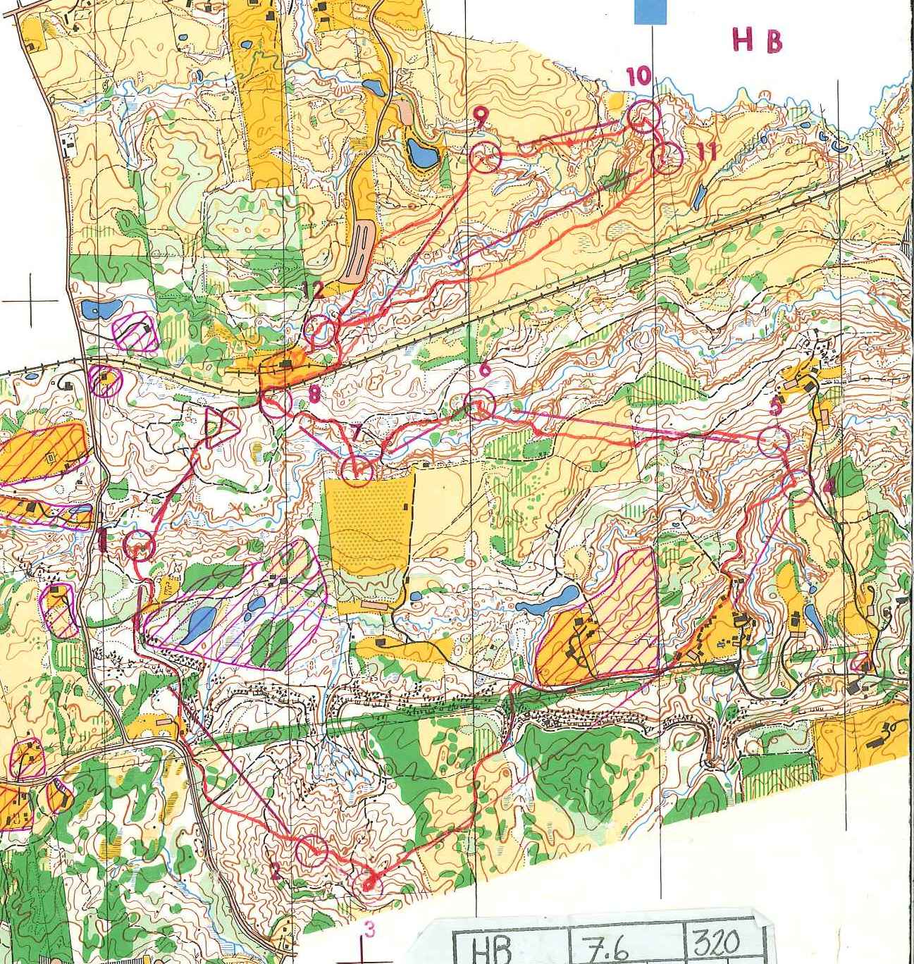
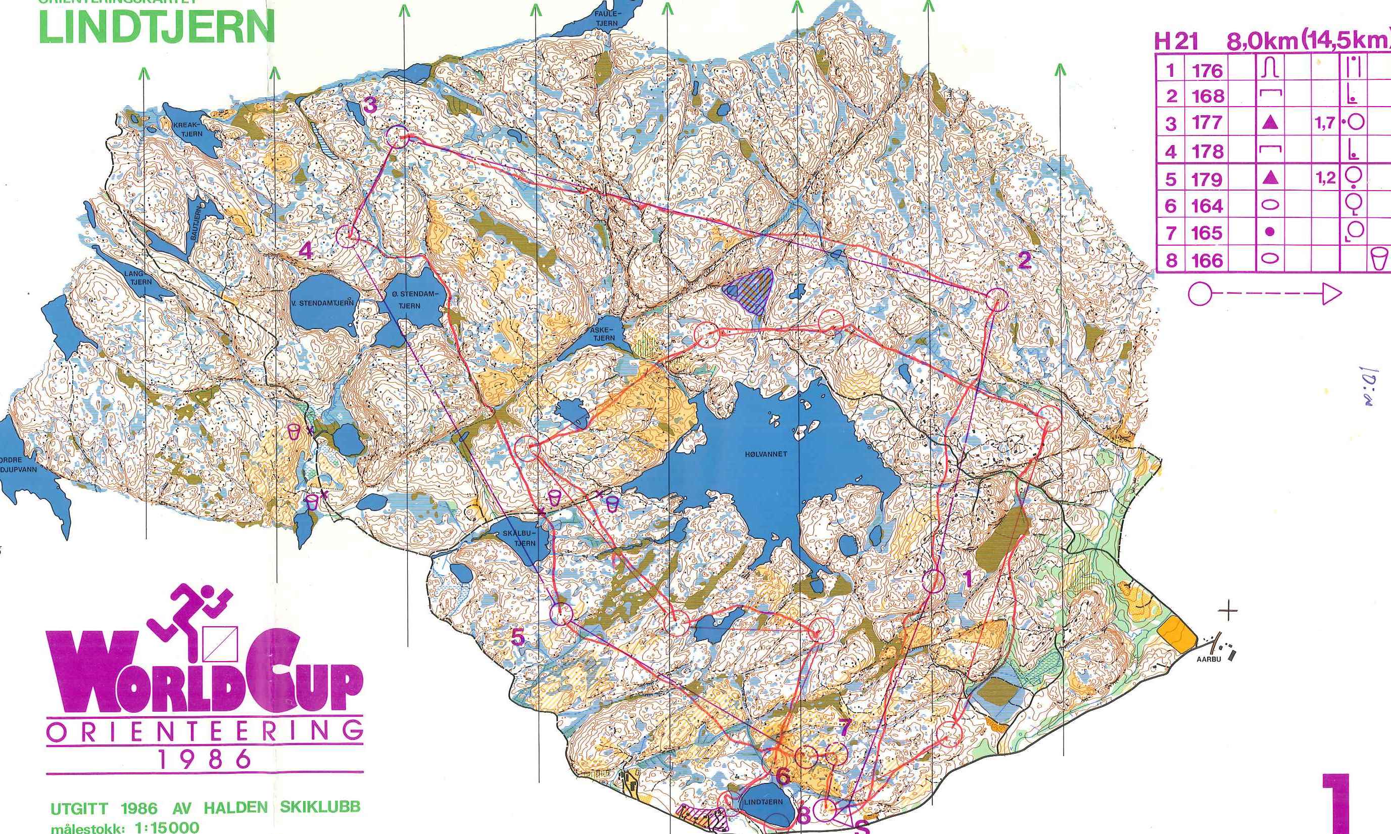
World Cup Halden, Norway, May 1986

fig.1. Individual

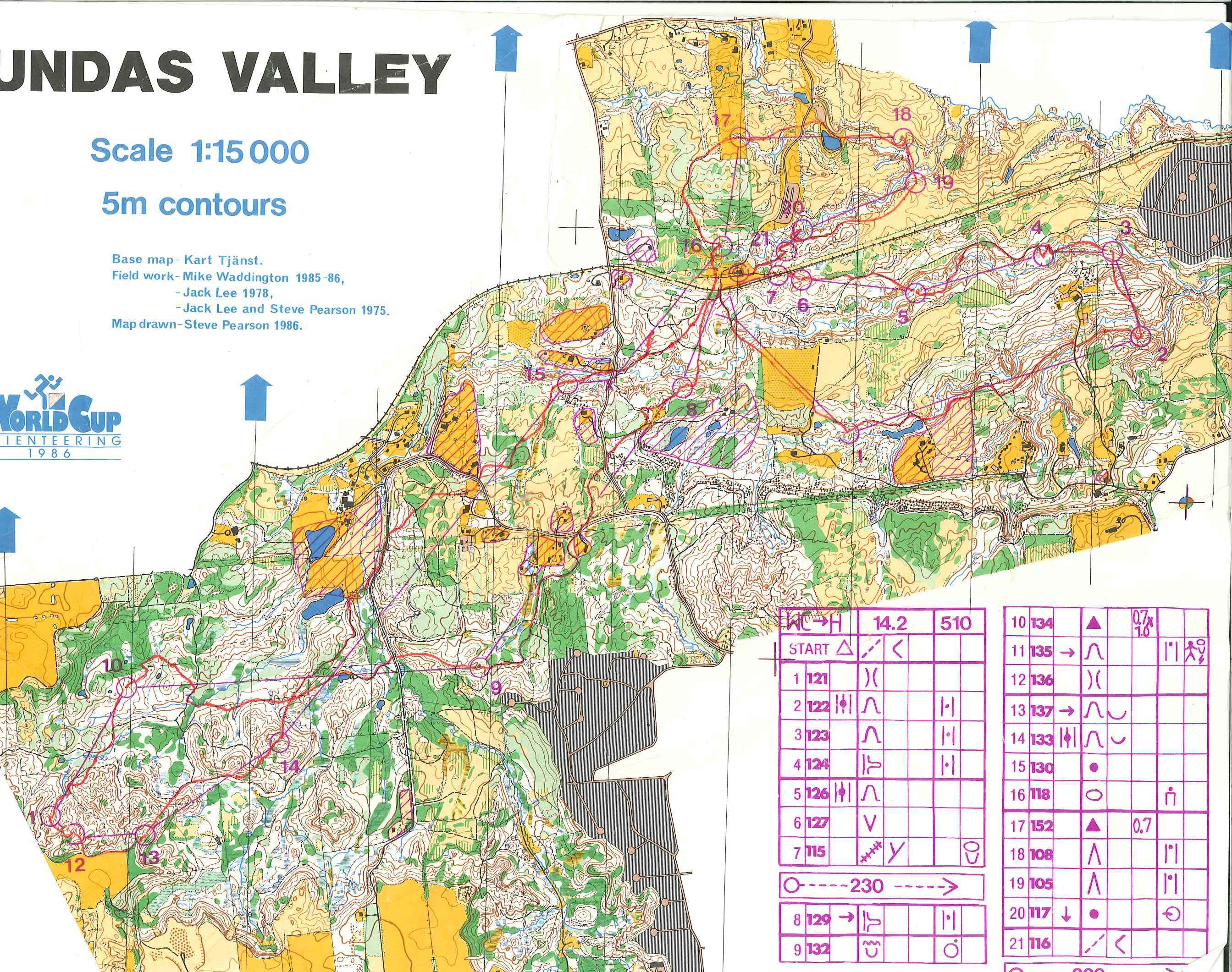
World Cup Hamilton, Canada, May 1986


fig.2. Individual

fig.3. Relay

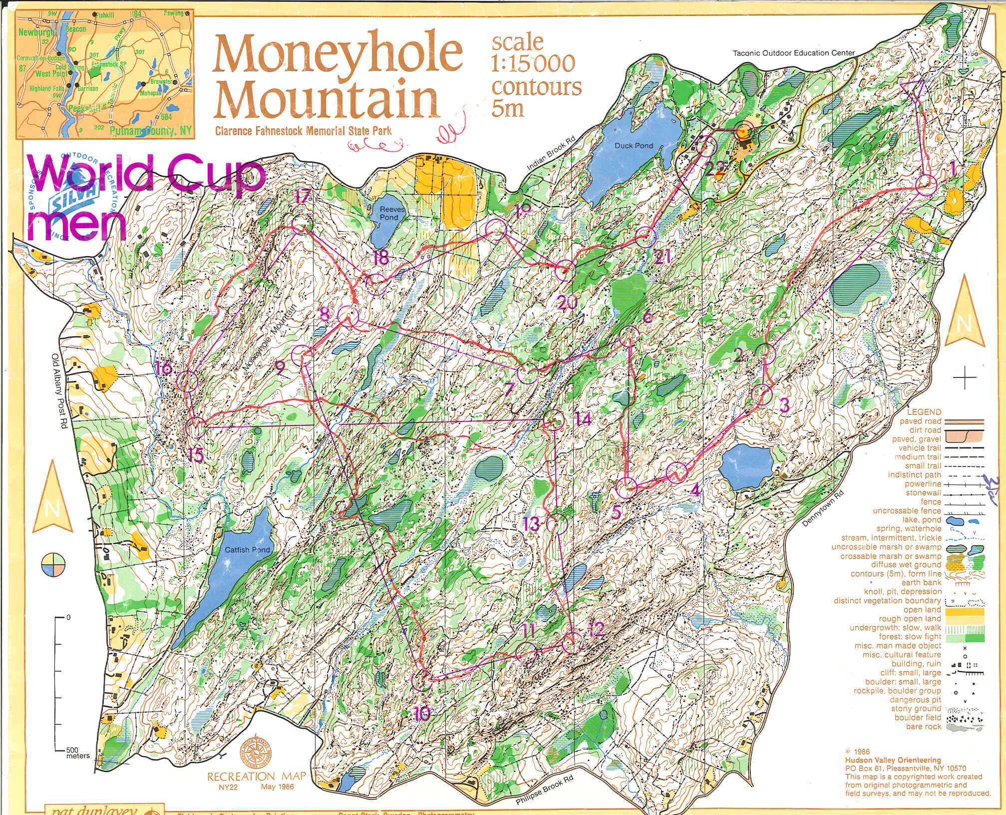
World Cup Fahnestock State Park, USA, May 1986

 fig.4. Individual

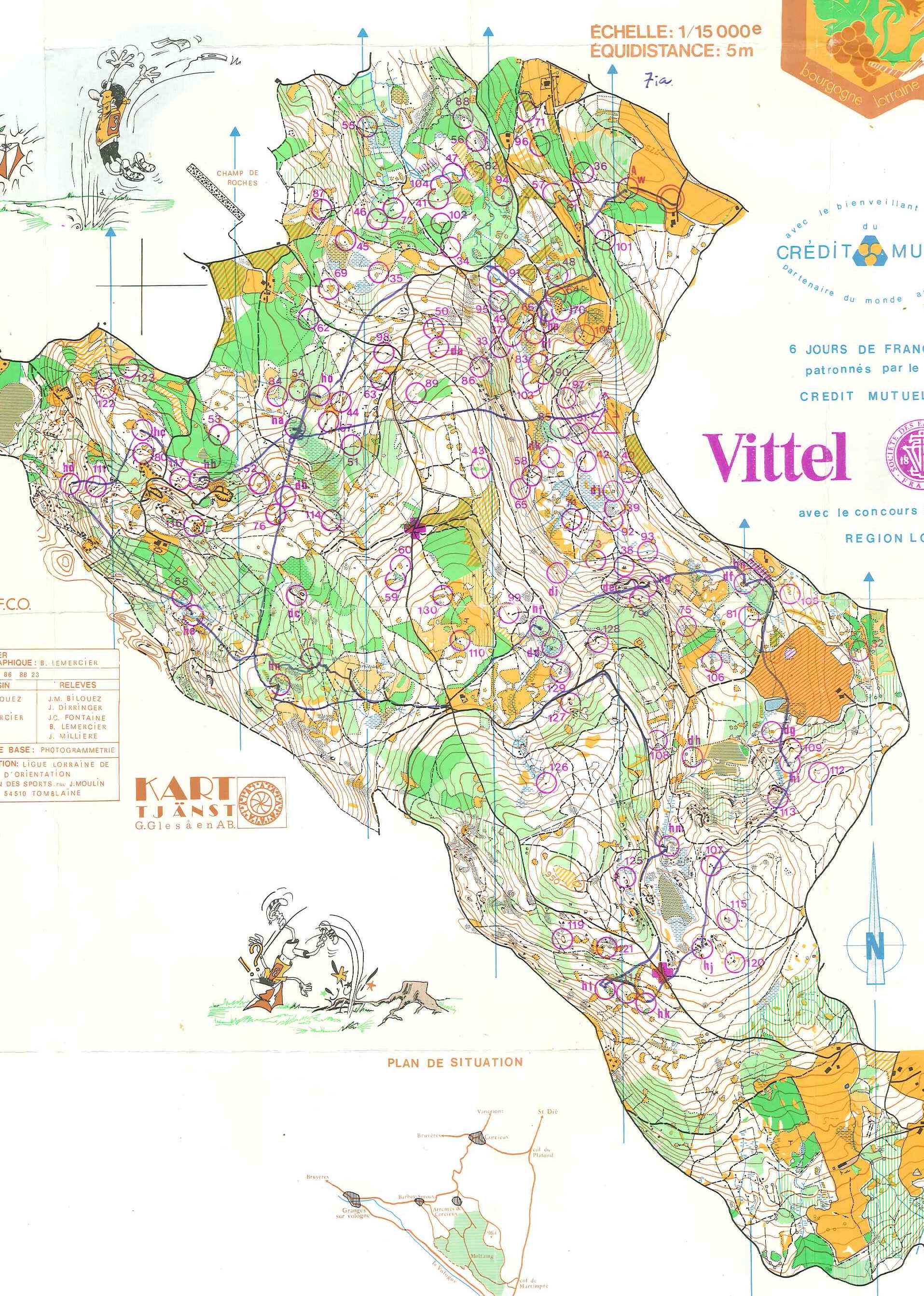
World Cup Raon L'Etape, France, July 1986

fig.5. Individual

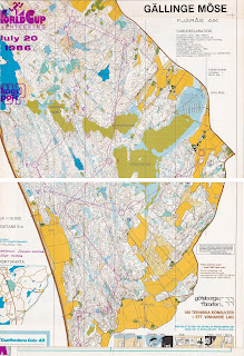
World Cup Fjärås, Sweden, July 1986

fig. 5b. Individual

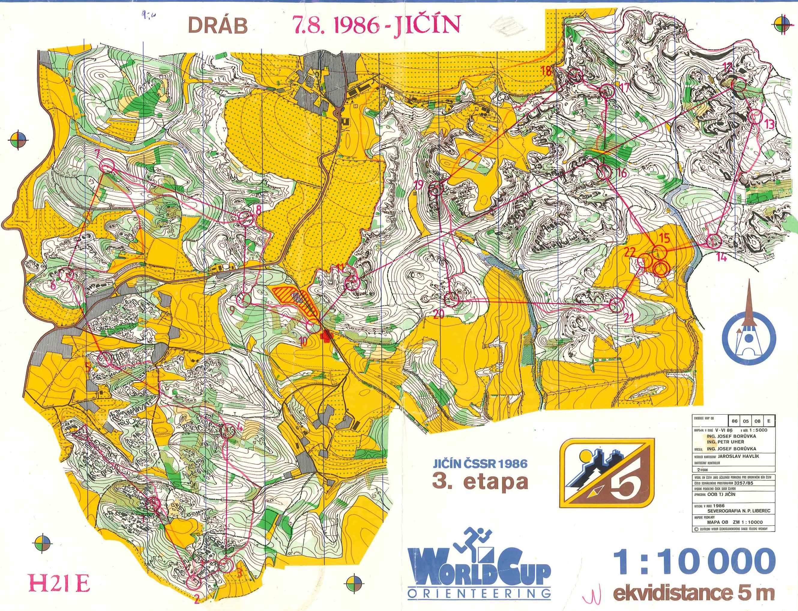
World Cup Jičín, Czechoslovakia, August 1986


fig.6. Individual

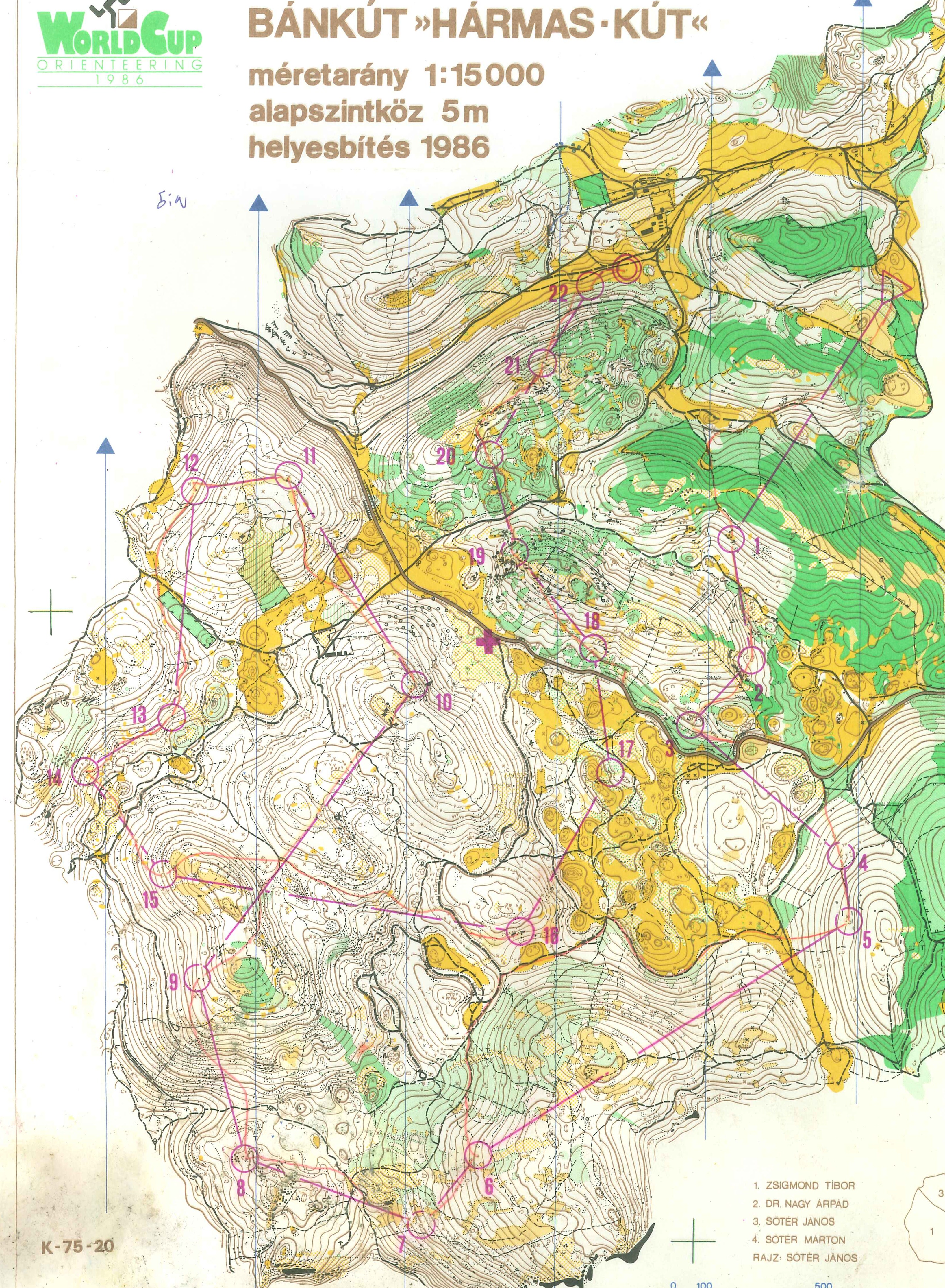
World Cup Eger/Bánkút, Hungary, August 1987


fig.7. Individual

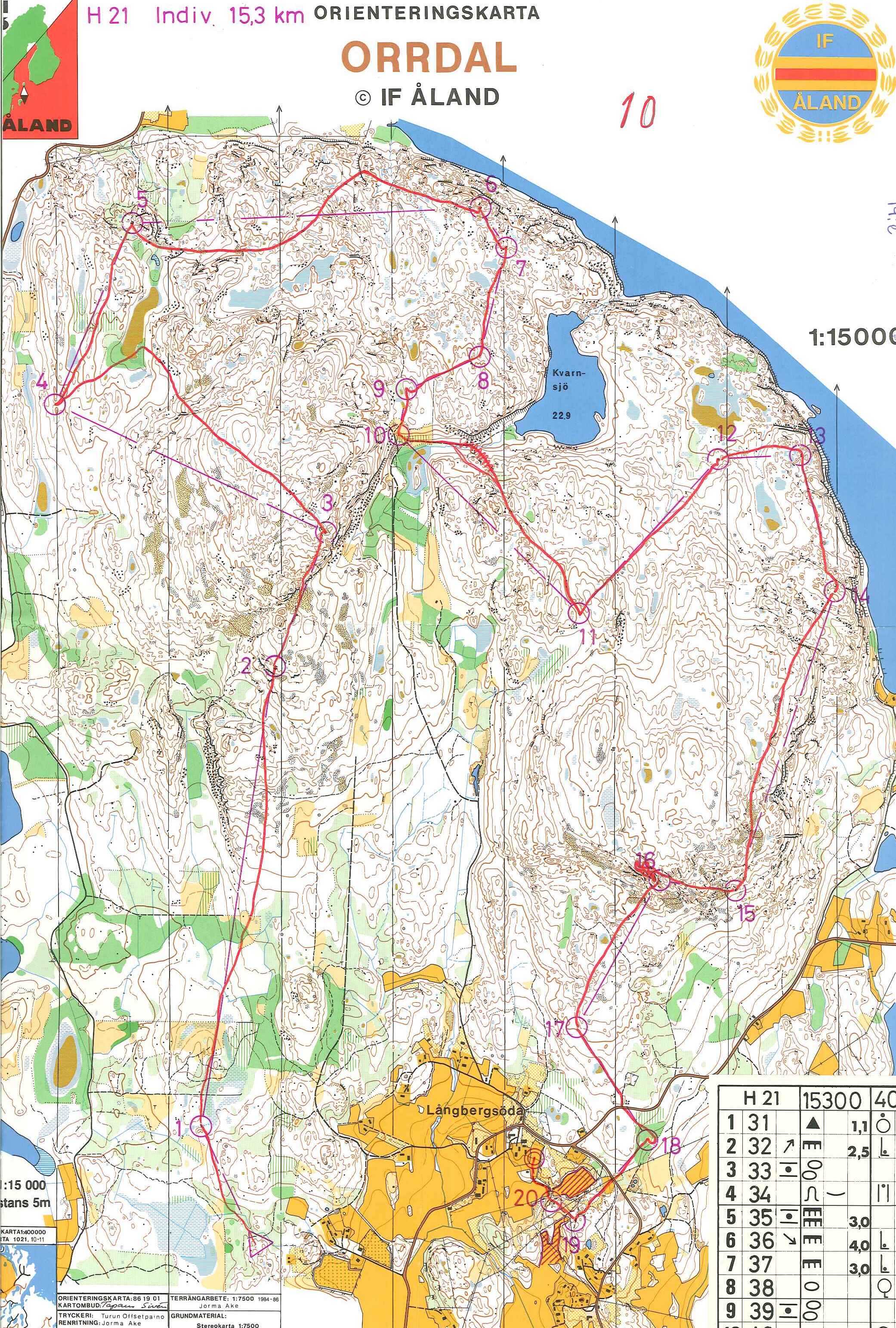
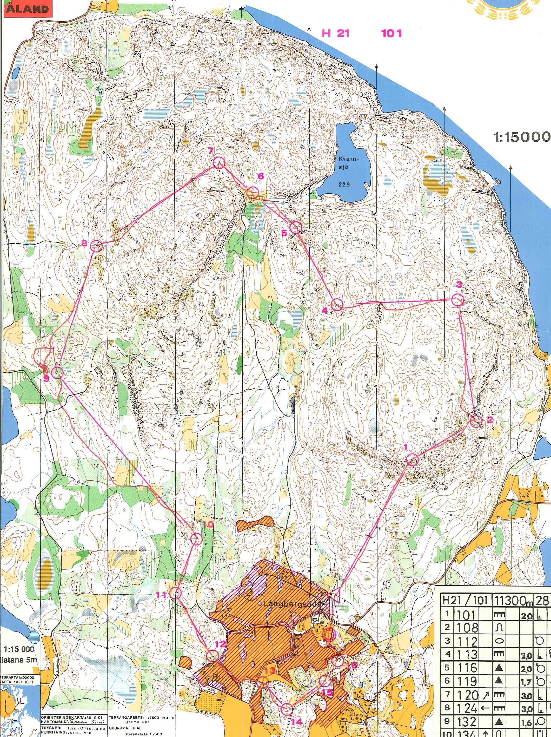
Nordic Open Championships, Åland, Finland, August 1987


fig.8. Individual

fig.9. Relay

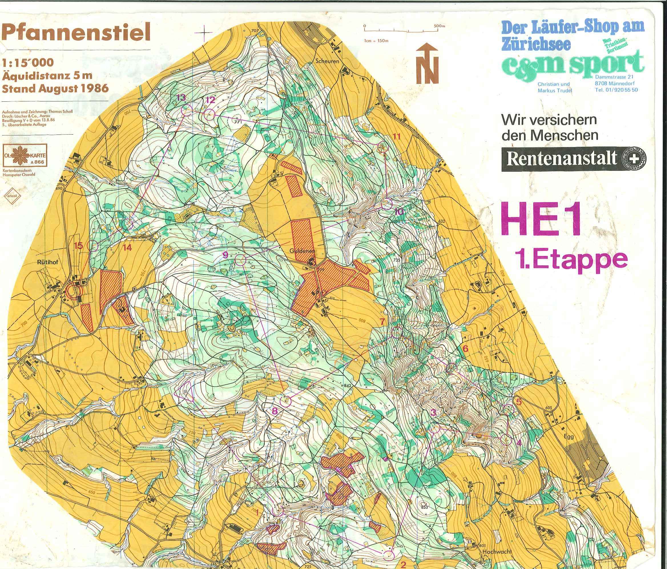
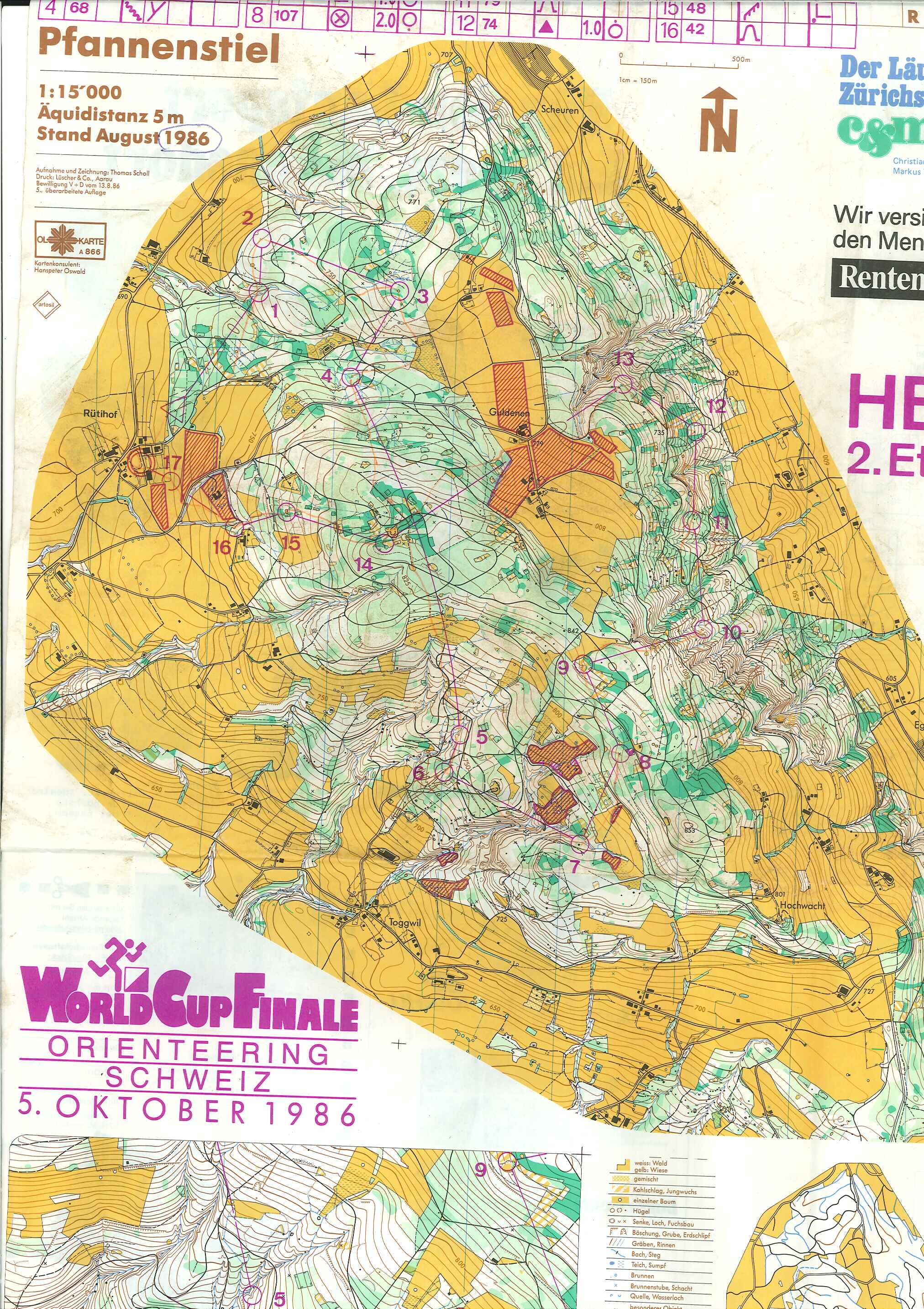
World Cup, Stäfa, Switzerland, October 1986 
fig.10. Individual. First part.

fig.11 Individual. Second part. (Chase-start? Map excerpt in larger scale and with different equidistance?)
Sonntag, 22. September 2013

Mappers Blog: Legibility

Mapmakers should understand that without the proper level of generalization the legibility of orienteering maps will not be suitable for the organization of fair events. The International Orienteering Federation keeps the aim of preserving the characteristics of the different event and discipline formats by ensuring the legibility of the event maps.
Laszlo Zentai, Member of the IOF Council, 2011

Donnerstag, 19. September 2013

Mappersblog: Must have if you run SM 2013 in Göteborg

If you plan to run the Swedish Championships this weekend you should not forget to wear your new ISOM2000 glasses.
fig.1. ISOM2000 glasses "yellow 50%"

For those who do not own one: The ISOM2000 yellow 50% is optimized to filter yellow 50%/PMS136 from you map. With other words: It is a visual spam filter you might not want to miss these days. I figured out a way to visualize the glasses effect.


fig.2. Without ISOM2000 glasses: yellow "gäggamoja"

 fig.3 With ISOM2000 glasses: white heaven.

So, see you on saturday with you ISOM2000 yellow 50-ties on!


Now am I getting serious

Jag tror faktiskt att man kan lura sig lite på att kartan är så detaljerad, men det går att luta sig åt kurvbilden och verkligen använda den i sin orientering.
Helena Jansson about this map in Skogsport 7/2013

The map actually is part of the training package for the Swedish Championships middle-distance. Figur 3 shows the maps version by Maths and Christer Carlsson from 1999. Figur 2 is the same map after the revision by Carl-Henry Andersson in 2010. If you look closer to the map you can see, that the contours drawing is the same. Colors and symbolization has changed a bit but the main difference is, that CHA added tons of what I call "characterizing details" making it easier to identify "navigational details". At the same time the maps readability took a serious dive, what makes Helena Jansson advising to mentally reconvert the actual map to the original map. ( or GET THOSE GLASSES! ;-)

I don't know. Is this really the direction we want to go? I suspect the whole is related to the new base material we get these days, primarily the laser which makes us see all these details in the forest and even if we explicitly fight to keep the map generalized it is still the laser we start from. So it is like a technical development shows us the way to go, ain't it?
 

Montag, 16. September 2013

WOC 1968


The WOC 1968 took place 40km south of Linköping, Sweden. The event is well documented by one of the organizing clubs, IFK Linköping OS (Link to their website dedicated to the WOC 1968).
Here I  add the maps in higher quality.
 fig.1. Map of the Individual Orienteering World Championships 1968, 28th of sept. 1968, Mens and Womens course, route by Dieter Hulliger. 5 men and 4 women per nation. 2 minutes start interval.
fig.2. Map of the Relay at the Orienteering World Championships 1968, 29th of sept. 1968. Men and Women. The different legs where distinct. In addition the first leg was run "individual" with a 4 minutes start interval. Based on that, the second leg started with a "chasing start".


As the portraits of the Swiss Selection...
 fig.3. Annerös Lüthi, Annekäthi Grieder, Ruth Galliker, Helen Thommen

 fig.4. Karl John, Alex Schwager, Dieter Wolf (did not compete), Fritz Maurer, Max Jüni, Dieter Hulliger.

[Map: Dieter Hulliger, Additional Information: Fachschrif für Orientierungslauf, Scan: Roger]

Samstag, 14. September 2013

Freitag, 13. September 2013

Mästarmöte 1975

The Swedish public service broadcaster SVT lately published parts of its archive online, also the live broadcast of the Mästarmöte 1975, an international competition near the Swedish town of Bollnäs 300km north of Stockholm.

The broadcast has many interesting aspects, such as this was one of the first attempts to send orienteering on TV.  The event organization can be described as simple and probably can be seen as the model for classic-o-challenge event. *
It is also a document in which we can actually see, how orienteering and in particular international top orienteering was these days. And we can see our icons in action and hear the reigning World Champion** Bernt Frilén talk about his race.


 Among the 18 men where the two Swiss Bernhard Marti and Dieter Hulliger. Marti can be seen in the broadcast at the start (37.30) during the race (1.21.45 and 1.39.00). Hulliger only after the finish (1.17.20) struggling to get rid of the punching card taped on his arm. The Swiss Annelies Dütsch competing in the womens race was not shown..

* Actually it is the generation of competitors of the 70-ties which stand behind the COC.
** There  was only one individual World Champion these days.

The KanPas Focus 200

So here is the KanPas Focus 200. Actually the compass making orienteering easy. Maybe even too easy? - Sorry for that. fig.1. What a beauty ...