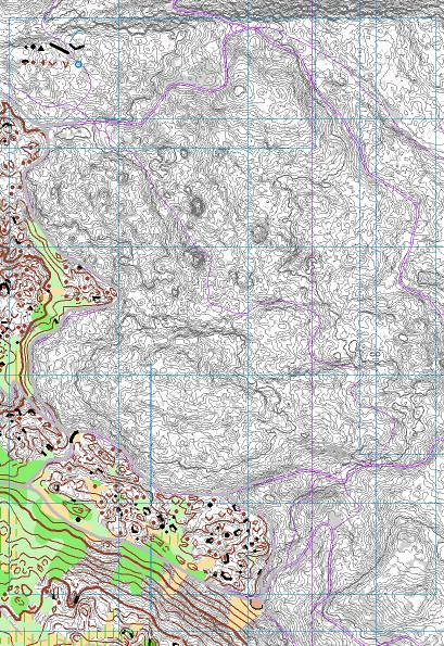
Some details:
- The base map itself bases on Laserdata, offical measurement data (violet), older maps and actual maps alongside.
- As the terrain is very detailed I am mapping 1:3500 for a 1:10K map to get some space for clean drawing. The less detailed part I map in 1:5K as usual. I try to keep the base map as decent as possible, so I print it out in grey-scale.
- As the terrain is complex the contourlines are provided with slopelines. Equidistance is 1m.
- The vegetation information (available from OCAD11, alt. Karttapullautin) I reduced to this grey surfaces in the background (grey means: No high or intermediate trees).
- Some size-reference objects in the upper left corner
- the blue mesh for referencing the field notes
- the other blue lines to organize the overlap of the different sheets
- violet: data from official measurents, but the laser data is expected to be more precise
- the bordering track of the existing map in the lower left corner is set to grey in case it has to be adapted
- Additionally I will carry with me a print of the map from 2000 mapped by Gian-Reto Schaad, Urs Steiner and Beat Imhof. I guess I can always learn from them.


Keine Kommentare:
Kommentar veröffentlichen