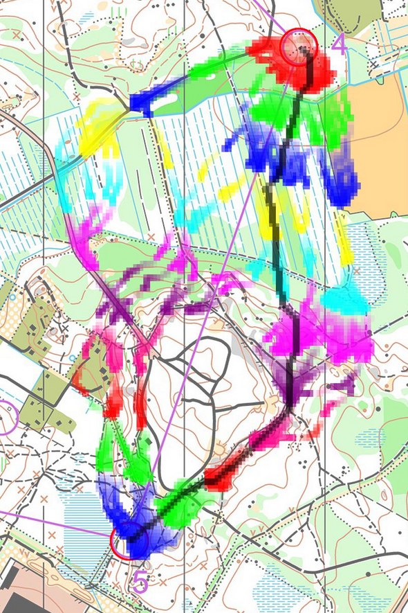
Abb.1. Isochronen-Karte NORT 2010 Mittel-Sprint Männer Posten 5. Die farbigen Bänder bezeichnen Regionen mit gleicher Zeitspanne vom Posten 4 bis dort. Schwarz: Die berechnete schnellste Route. Basis: GPS. Quelle:
WorldofO.com
Abb.2. Gleich wie oben, ergänzt. Isochronen-Linien und eine Skala zum Vergleich des Fortschrittes in Richtung Posten 5. Oliv: Nicht passierbar. Farbliche Unterscheidung der Fronten entsprechend der vier Hauptrouten links, mitte-links, mitte-rechts, rechts (Eigene Darstellung). [Bem.: Ein ähnliches Problem wie bei der
Tageskarten-Karte.]


1 Kommentar:
I like your illustration. That's actually what I hoped it would look like when starting out, but I haven't managed to make it that nice looking autmatically... Any ideas are very welcome:)
Kommentar veröffentlichen