Mittwoch, 28. Oktober 2015

Mappers Blog: Bannwald Setup/ Symbolization, localization and cartography

My most recent project is about to end and therefore it is maybe time to take some notes. I mapped the area of Bannwald as part of the map Seebodenalp, a cooperation with Heinz Tüscher. My part consists essentially in a steep, forested slope with partly dense vegetation and partly abundant rocky features. The area has been mapped before in 1984 but has never been updated since.

 fig.1. Map from 1984

Assessment

I had to figure out, how to tackle the task and there where basically two questions to answer.
1) How to get there? - The slope is situated from 700 to 1000 a.s.l. and starts about 250m above the closest transport stop in Küssnacht a.R. (about 50km from where I live). There is a cable car running up to Seebodenalp but with a restricted time table and a restricted connection to the public transport. No cheap accomodation in the area. I can not loose to much time getting there and away.

2) How to localize? The regional council provides us with a laser-DEM and -DSM but it was produced in back in 2002. This means it has a relatively poor point density, is rastered, filtered (extracted leaf-trees), smoothed (extracted boulders) and in regard of the vegetation partly outdated. Thus a pretty oldtimer compared with a nowadays point cloud. In a relatively uniform slope with lots of stones and cliffs and rocks but also green features to be localized, such a base is not sufficient.  As the slope is facing north-east GPS is no big help (actually when ever was GPS  a help :-P).

New tools

Thus I was forced to update my setup and did this by:
1) Buying a scooter
fig 2. A scooter is the mappers best friend...

2) Borrowing a Range Finder 
fig.3. No! The Range Finder is the mappers best friend.

It is a TruPulse Range Finder able to measure horizontal and vertical distances, something especially handy in steep terrain.

Usual Hardware/Software-Setup 

Otherwise I the setup has not changed essentially since my last documentation. I am still very happy with the combination of OOMapper on a waterproofed Samsung Galaxy Note 2 (inductive pen technology).
fig.4. The Bannwald Setup (note the waterproofed pen)

Hybridal Mapping with OOMapper

One of the advantages of OOMapper compared with OCAD is the possibility to map hybridal: While you can digitize smaller features right away, you just can sketch features "under construction" f.ex. contours and larger areas with undergrowth.

 fig.5. Screenshot Hybridal Mapping with OOMapper.

Symbolization, localization and cartography

For me nowadays, mapping is a three step procedure, symbolization, localization and cartography (generalization & legibility) or with other words: What (aka ISOM)? Where on the map? and Does the map work (aka cartography)? 

Localization

While it was a big part of the job to localize map features correctly in the older days, I aspire to have this problem solved beforehand. Localization should generally be no big question. In the case of Bannwald I could base localization on these three base maps I could switch between.
fig.6. As done before I work with the 1.25m contours which also work as bands for contour and evtl. form-lines. Basemap calculated with OL Laser.

fig.7. The contours I combine with the vegetation height (the contour layer is semi-transparent). Basemap calculated with OCAD.

fig.8. Rarely I also used the steepness perspective. Basemap calculated with OL Laser.

Finally the mentioned range finder was the crucial tool in regard of localization. The model I borrowed would be able to directly communicate with OCAD by bluetooth. Although myself working with OOMapper I had to manually draw the measured distances on the map. For this purpose I used a helper symbol consisting in a 20m long scale.

fig.9. Helper symbol 20m scale

fig.10. Map draft with included range finder measurements.

Life cartography

Besides the possibility to switch between base maps as it suits you best, digital mapping has an other big advantage in contrast to the good old analog one: Now cartography can be considered on-site. I do this by using a set special set of symbols, I developed for the purpose of field work. This leads to that all cartographic conflicts can be solved right away.

fig.11. Some symbols of the field set.

Hence

So this was probably the hardest job I ever made spending 18 days to map 1.3 sqkm. If I would not have adapted my setup, it would have taken much longer. The map will be published next spring to be used for the 39.Innerschwyzer OL. Come and try!

Montag, 26. Oktober 2015

17th season in the Swiss National Team for Baptiste

The selections for the Swiss National Senior and Junior- Team have been published yesterday.

Changes for the new season 

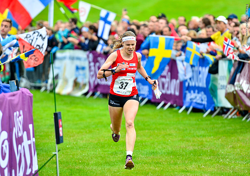
fig.1. After 12 seasons with the National Team Sara Lüscher retired. (WorldofO.com; Sara Lüschers athlete profile)

Retired/not selected: Sara Lüscher (29, A), Bettina Aebi (25,B), Marion Aebi (22, B), Andrea Roggo (20,J), Laura Diener (20,J), Sonja Borner (18,J), Remo Ruch (20,J), Jannis Schönleber (19,J)

In came: Valerie Aebischer (18,J), Katrin Müller (18,J), Deborah Stadler (18,J), Simona Aebersold (17,J), Marcia Mürner (17,J), Sebastian Baumann (19, J), Nick Gebert (18,J), Andrin Gründler (17,J)

Upgraded: Sven Hellmüller (20, J->U23), Kerstin Ullmann (20, J->B), Lisa Schubnell (20, J->B), Sandrine Müller (20, J->U23)

Years in the National Team (incl. 2016)


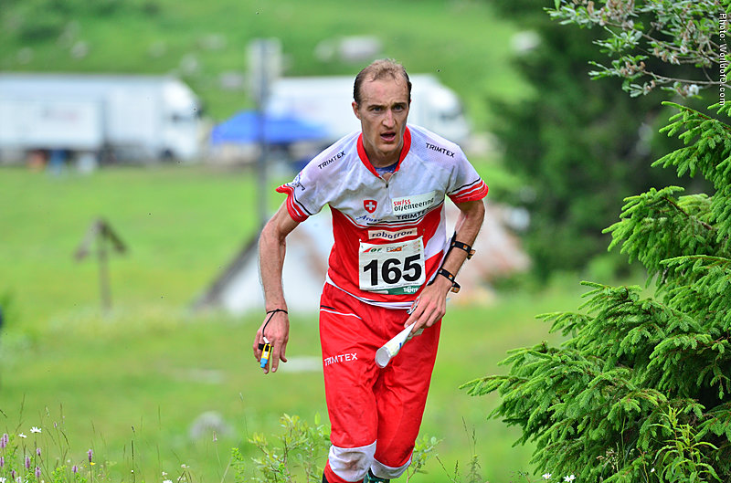
fig.2. The Nestor of the Swiss National Team: Baptiste Rollier looking forward to his 17th season in the red-white dress. (WorldofO.com; Baptiste Rolliers athlete profile)

Baptiste Rollier 17 seasons
Daniel Hubmann 16
Fabian Hertner 14
Andreas Rüdlinger 14
Rahel Friederich 13
Judith Wyder 11
Andreas Kyburz 11
Raffael Huber 11
Sabine Hauswirth 10
Martin Hubmann 10
Matthias Kyburz 9
Julia Gross 8
Sarina Jenzer 8
Florian Howald 8
Alain Denzler 7
Florian Schneider 6
Elena Roos 5
Lisa Holer 5

Overview Swiss National Team Since 1999


I updated the chart with the selection dynamics since 1999.

Dienstag, 20. Oktober 2015

Mappers Blog: It was not your fault! Blame the map.

A short analysis on the Glarus Schwändi Map, used for the Swiss Middle Championships last weekend. I was the mapper and I ran the H 40 course for testing purposes. What I am doing now is go through the course and check where the mistakes where made and look for possible map related contributions.

The map

So first, here is the competition map. Have a look at it. Which controls might be tricky?
 

 The rates of mistakes

Here is what winsplits says, if we apply the default 20 seconds/20 percent rule.

And btw. he total number of participants is 46.

Control by control 

The first control is a short one and actually pretty easy. I can be spotted from 50m. Still there is a 30% mistake rate (MR) here. Partly it can be explained with the stressed starting situation. But otherwise one has to admit, that the control ring mask the bigger land form. Also there is a missing dash point on the eastern small knoll.
Same excerpt without overprint.

The second control was easy on the leg, but it seems some (20%) had problems to find the right side of the right stone here. Note how the contours interfere with the black objects.

Then a series with easier controls to 4 ....
... 5, 6, 7....
... 8 and 9. The easiest control of the course.
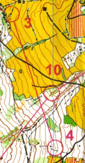
10 also looked easy but it some took it too easy. Might be a consequence of the climb to 8.
In this section the overprint again masks the terrain. Mostly the dell on the way into 11 and along the gully towards 12. At 12 the MR starts to rise again to over 20%. The mapping inside the control circle is not that clear.

And now to the most tricky section. At 13 MR is 30%, 14 tops with 43% and 15 follows with 21%. 13 and 14 are pretty easy legs, if you look on the map excerpt without overprint below...  13: follow the ditch, 14: follow the valley. A smaller mapping issue can also be spotted south-east  of 13 where the contour has a gap crossing the ditch.

After a pretty physical leg to 16 with a low MR 17 and 18 came back with 26% MR both. The cartographic issues here: The small knoll south of 17, suiting as attack-point is very prominent, but was drawn with a form-line due to over-correctness. A possible source of irritation.  Then on running speed it was not possible to see that the 17th was no boulder but a knoll. Small brown surfaces just melt together with black.
The cliff for the 18th control was, as you can see from the excerpt below, added to make a control point by the course setter...  and therefore was the least prominent cliff mapped on this map.

The last control was no problem from this side. But the elder Hubmann lost some precious seconds going straight over the hill from south-west. Also here the over-print mask the contours.

Resolution

1) Check for the effect of the overprint on the terrain representation, not only the control ring but also the connecting line.
2) Check for legibility issues not only for features with the same color but also between features with similar colors (brown-black)

Dienstag, 23. Juni 2015

Leading orienteering nations since 1966

fig.1.: Ranking of leading countries at successive WOCs 1966-2014 (host countries highlighted).

Fig. 1 is taken from an article by Dave Nevell from the April issue of Britain's National Orienteering Magazine CompassSport by courtesy of both author and magazine. Its content is described the following:
The countries have been ranked on how well their overall teams have performed each time round, based on the average gap beteween their runners and the average medal winning times for each discipline. Adjustments have been made for lower numbers of runners (e.g. non-qualification for the final). This then gives an idea of the current world order...
The graph is impressing as it visualizes the ongoing and total dominance of the top 4 since the beginning of modern orienteering. Sweden, Norway, Finland and Switzerland took 93.5% of all top four. While these nations all have between 27 and 30 top four positions over the years, former Czechoslovakia -> Czech Rep. got 5, Denmark, Russia and France each got 1.


Dienstag, 5. Mai 2015

Mappers Blog: Fürstenwald setup

fig.1. Fürstenwald setup.
Now have even I changed side and started to map fully digital. The main reason besides I like to challenge myself was that Open Orienteering Mapper opened up a way to step into digital mapping before and without spending a lot of money on hardware. So here I document the setup developed for revisioning the map of Fürstenwald, Chur, Switzerland.
The point with digital mapping is, that you can choose your base map according to the actual task.

Hardware

fig.2. The  overview
  • Samsung Galaxy Note 2, 5.5 inch screen
    • with S Pen (inductive) and extra S Pen (waterproofed)
    • with 1 original battery 3100 mAh and 1 extra battery 3400 mAh (total 13h with GPS on and screen on max)
    • inside a waterproof case by redpepper
    • protective film (anti-glare)
  • compass Silva
Pics:
fig.3. Normal and waterproof S Pen (Latex & shrinking hose)

Comments: Seems to me pretty ideal for mappers. Inductive pen, allweather and easy energy supply handling (no external battery). Total weight: 250gr. Total costs: about 200 CHF /190 Euro (Phone bought second hand)

Software

fig.4. Screenshot OOM 0.5.96 with old map as basemap, scribble plus activated GPS tracking and positioning.

  • Open Orienteering Mapper 0.5.96 for Android

Comments: One of the advantages of the OOM is, that you actually can continue working like you did in the analogue days. You just can scribble your features on the map. This is useful for features can not finalize directly (f.ex. wide greens). Of course, the rest you directly draw as map features. Other advantages: it is free and it is under development. You can contribute to its future.
A disadvantage of OOM is that it is not (yet) 100% compatible with recent OCAD formats (bascially some difference in dashing and no virtual gaps in OOM). In the actual case, revising an existing OCAD map, I therefore imported scribble tiles (georeferenced pngs) and digitized objects into OCAD11 for the finishing.

Basemaps

  • Snapping Grid
  • Old Map in gray and magenta tones
  • LiDAR Terrain Model contours 1m
  • LiDAR Surface Model (Both slightly outdated (!) therefore an recent additional Aerial)
  • Aerial Orthophoto
fig.5. Live extraction of natural borders from the orthorectified aerial photo
fig.6. Old map overlayed with 1m contours. Also visible the snapping grid (thin hairlines)
fig.7. Screenshot defining vegetation borders based on the DSM.

Comments: To fit in changes into the existing map, I use a "snapping grid" consisting in the old map features vector lines. Basically very thin/optionally invisible lines (in protected mode) I can snap to while drawing new features.
In this case the other base maps or "locator maps" where  provided. As  stated in the quote above the strength of digital mapping is, that you can choose base´maps after the actual situation. In open forest you can identify every single tree with the surface map. In more dense forest the contours are a big help. The internal GPS is indeed the very last measure.

Sonntag, 23. November 2014

Overprepared Competitions: Ski-O EM 2015

The organizers of the 2015 European Champs in Ski Orienteering decided to publish an auto-generated map over the competition area to ensure same conditions for all competitors.
The area had not been mapped before, but the data used for the maps generation is freely available. Additional data as the set-up of the public ski track network from here and here can easily be added. Maybe even direct from your own GPS-device?

Samstag, 22. November 2014

Swiss Team Preparations for WCup Final Switzerland

Taken from the Swiss Orienteering Magazine 11-2014:
Julia Gross nimm zur mentalen Vorbereitung  des Wiss Teams Stellung und erzählt: "Wir haben auf der alten Galms-Karte Bahnen gelegt. Ich glaube, es waren zum Schluss acht verschiedene Vorschläge." Die Bahnkonzepte haben die Läuferinnen auf "Dropbox" gestellt, um sie allen Teammitgliedern zugänglich zu machen. Dieses Angebot haben selbstverständlich nicht alle im gleichen Ausmass benutzt. Für dieses vorgängige Kartenstudium hat Judith Wyder nicht viel Zeit aufgewendet, doch sie präzisiert: "Für mich war es wichtig, zu wissen, welche Forststrassen Steigungen aufweisen, denn dies könnte im Wettkampf unbesonnen übersehen werden."
Das tolle Teamresultat verdeutlicht, dass die Schweizerinnen mental gut vorbereitet waren. Auch einige Stimmen dazu bestätigen dies, so Elena Roos: "Ich habe es genauso erwartet. Wenn sich die Möglichkeit bietet (sic), so habe ich wie im Vorraus vorgenommen, die Wegroute gewählt." Und Julia Gross ergänzt: "Im Team haben wir das Bahnkonzept vom siebten Posten bis ins Ziel genau richtig erraten." Es zeigt sich zudem, dass sich die Schweizerinnen auf der langen Teilstrecke richtig entschieden haben. Einzig eine schlechte Ausführung der Route führte zu einem Zeitverlust.
Text by Thomas Hodel.

Donnerstag, 30. Oktober 2014

Swiss Selections 2015

Here you find an update of my chart visualizing the careers of the members of the Swiss National Team since 1999.

Freitag, 29. August 2014

A summary from the centrum ok traininglab.

I here resume my time as a member in the training committee of centrum ok, this absolutely outstanding club in many concerns. One of these is that the club consist mainly of people in the middle age, mainly beginners or coming back after longer absences and pretty few holding on since youth. As the club was only founded eight years ago it has a nice lack of tradition which gave me the opportunity to test some orienteering trainings I was theorizing about earlier or to which I was inspired by others.

Generalisation / contour lines

r.du..d m.p

Concept: The map is reduced on the leg (only contours and some important symbols) but complete inside the circle.
Conclusion: Pretty demanding.

Routechoices

The route test (I against I against I)

Concept: The participant runs the same loop three times on different routes to really evaluate his/her route choices.
Conclusion: Interesting

Just a looong leg 

Concept: What the name says: Just a looong leg.
Conclusion: Fun I GPS and 2DRerun are involved.

Being Jerk R. m.m.

Concept: A night-training for beginners. A veteran leads a group of beginners through the course  and loudly shares his concepts and reflections.
Conclusion:  Pretty effective and good for the integration of the new ones into the club.

Compass

 The tree moves (compass-training)

Concept: Here we trained  proper compass handling by focusing on the bodies moves. (1. To hold a direction turn your body until compass, map and the bodies vector get in accordance.  2. While the bodies temporary leaves the accordance, keep map and compass in it by outbalancing with your arm 3. If you change direction you are aiming to, turn your map and then bring everything into accordance)
Conclusion: Positive response

Compass Maze

Concept: This is supposed to be a compass training in three parts: A long leg, a maze and a series of short, turning controls. Especially the maze is demanding as it forces the participant to work with most objects only on-sight.
Conclusion: Very demanding.

 Stay on the line

Concept: Another night compass training. This time the task is to stay on the use the compass to stay on the purple line wherever it is applied.
Conclusion: Demanding and useful.

Pac Man Maze

 Concept: Another maze with the special feature, that "monsters"  may not be are moving inside the maze which may not be intersect.
Conclusion: Demanding fun!

The straight corridor

Concept: Straight corridors to train a combination of compass and detailed navigation
Conclusion:  Useful, especially in terrain which otherwise is known or as dominant track network.

 Broad view

Anti-corridor

Concept: Participants try to stay on the line, masking the map. That way they are forced to navigate the map aside the line to succeed.
Conclusion: Tough and useful.

On sight orienteering

Concept: A control is punched as soon as it is spotted (I got this from okansas). Most of the controls are marked with a colored ribbon. Some have actually flag. There the team switches role from  spotter to controller and vice versa.
Conclusion: Demanding for the participants and the organizer

The  eagle eye

 Concept: Training in pairs (spotter & controller). On the way to the control the pair must mandatory spot the objects marked by green circles. Pointing out shall happen as early as the object gets in sight. To put the pressure on the spotter, the controller will point out that s/he saw the object about ten seconds after it happened. Change of the rolls as soon the spotter spotted the regular control or the respective object. Discussion after the training on the different usability of objects as beacon.
Conclusion: maybe a bit too much? Nice layout by Daniel though.

The Sailor

Concept: Another anti-corridor combined with the some "missing control objects". Both aim to train a broad view.
Conclusion: Demanding and useful (plus nice layout by Daniel)

Mapreading

Golf orienteering

 Concept: Train longer map contacts by trying to minimize them.
Conclusion: Fine and Fun.

Relay

Malus-Massstart

Concept:  the performance in our club is spread. So you need to think of training setting fun for everybody. In this case me and Daniel tried to keep the group together by letting the pack leaders run some extra controls. We therefore grouped the controls. At every control we fixed pile with a elaborated number of post-its (the earlier in a "group" the more). Participants punched by picking one sheet (as long as there where sheets left). As long as one managed to get a sheet s/he was allowed to continue. Instead as soon as all sheets were picked one should proceed directly to the beginning of the next group of controls.
Conclusion: Fun!

Jukola-training (in pairs)

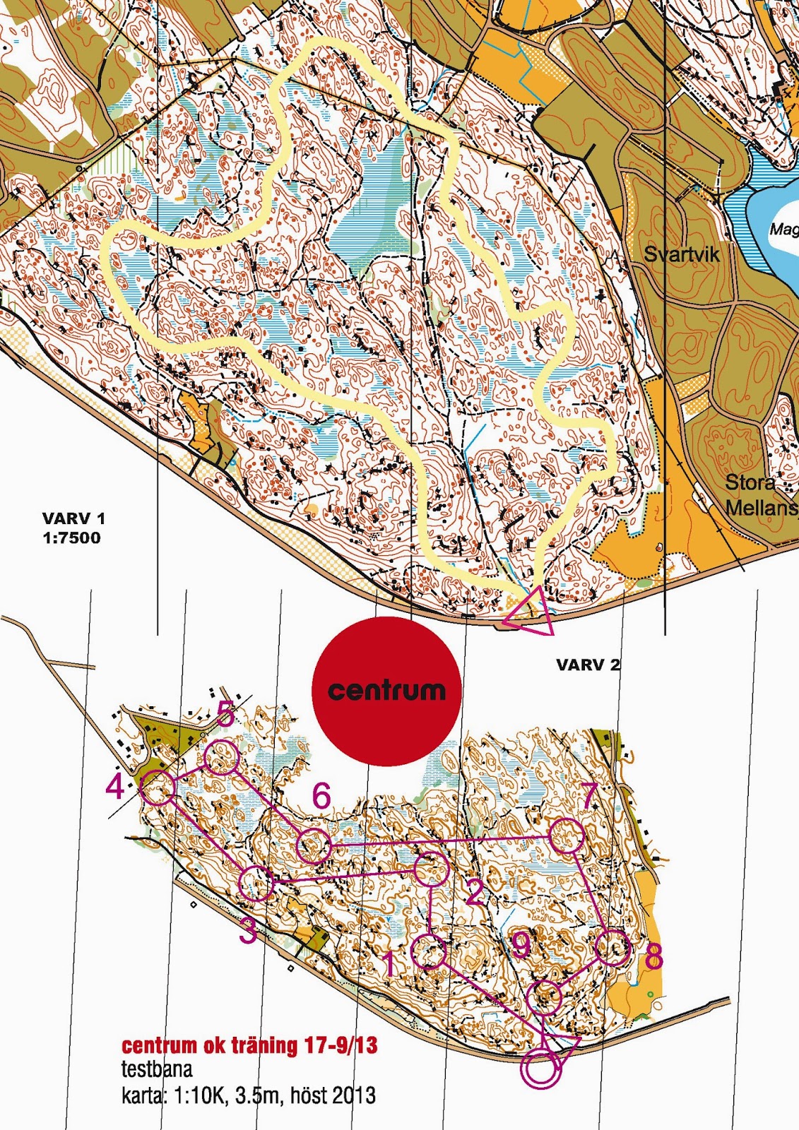
Concept: On our level   independent route choice at big relays is almost ever the wrong choice. It is more often faster to stay in the pack and to control what the pack actually is doing. In this exercise we build teams of two runners equipped with to different maps (see above). The first leads on the long leg towards his/her control, being there, the second takes over the lead to his/her own forking and than on the following longer leg, while the other, following keeps track on where the pair is actually running to. etc.
Conclusion: Useful.

Jukolatraining with focus on start

Concept: One particular thing with the big relays is, that you never know exactly when to start until 45 seconds before you will have to. In this exercise we combined a pretty common midsummer night-training  with the element of the big relay (not mass-) start element.  We let them start hasty, we let them start late, we let them start alone, in groups and in a chasing position. All directed by a prepared timed script which is read at the start. Another element I used here where unanounced forkings.
Conclusion: Fun and useful to simulate.

Tactics and fun

Team Orienteering

Concept: A team has to complete a course (punch the controls in the right order) but must not stay together all the way.  This is a common competitive discipline in Switzerland. The course should open the many possibilities to short-cut opening up for the tactial and coordinative game.
Conclusion: Fun!

Dart-orienteering

Concept: A one hour score orienteering with the specialty, that the participants are only allowed to pick a certain number of controls before returning to the starting point. The number for each turn is defined by how good they perform with darts. Thus something like biathlon.
Conclusion: Fun.

o-zeugs over and out (late wc china finding)

Yes. Let the o-zeugs blog rest in peace. I´ll take it down eventually. And yes, I stumbled over the decisions of the Ethics Panel regarding ...